Roseville, California Map and Directory
Regional Directory > States Menu > California
 According to the United States Census Bureau, Roseville is a City that is located in Placer County, California at 38.75 degrees North and 121.29 degrees West.
The city's time zone is America/Los Angeles, and the city's primary telephone area code is 916.
The land area of Roseville is about 42.21 square miles, whereas the water area of the city is about 0.00 square miles.
Placer County's land area is about 1,407 square miles, so the city occupies about 3.0 percent of the county's total land area.
According to the United States Census Bureau, Roseville is a City that is located in Placer County, California at 38.75 degrees North and 121.29 degrees West.
The city's time zone is America/Los Angeles, and the city's primary telephone area code is 916.
The land area of Roseville is about 42.21 square miles, whereas the water area of the city is about 0.00 square miles.
Placer County's land area is about 1,407 square miles, so the city occupies about 3.0 percent of the county's total land area.
The Census Bureau estimates that Roseville had about 141,500 residents in 2019, which is approximately 3,352 people per square mile of land area.
According to recent American Community Survey data, the median household income in Roseville was about $89,082 per year.
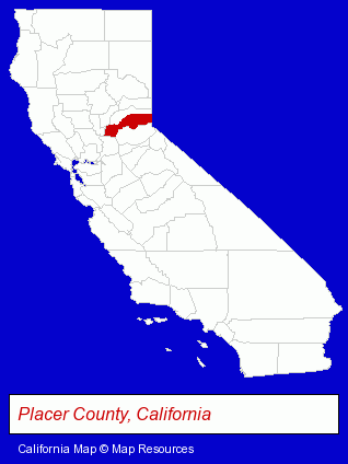
The California counties map at upper right shows Placer County, highlighted in red. Use the menu below to display interactive maps of Roseville, either in a frame on this page or in full-screen mode.
Use the menu below to display categorized Roseville directories.
Selected Roseville, California Listings
These randomly selected Roseville listings provide some insight into the city's cultural environment and economic climate.- Bookstores
- Collectibles Dealers
- Comic Books
- Comic Book Dealers
- Family Restaurants
- Dessert Restaurants
- Late Night Dining Restaurants
- Notaries Public
- Industrial Equipment Rebuilding, Service & Repair
- Brake Service & Repair
- Antiques
- Antique Dealers
- Building Remodeling & Repair Contractors
- Real Estate Inspection Services
- Asbestos & Lead Abatement & Removal Services
- Carpet Cleaning Products Wholesale & Manufacturers
- Financial Planning Consultants & Services
- Music Instruction
- Instrumental Music Instruction
- Vocal Music Instruction
- Dermatology Physicians & Surgeons
- Certified Public Accountants
- Building & Home Construction
- Builders & Contractors
- Roofing Contractors
- Roofing
- Loan & Financing Services
- Building & Home Construction
- Architects
- Architectural Services
- Interior Decorators & Designers
Nearby California Cities and Towns *
- Carmichael (4) - Carmichael, California information and maps.
- Citrus Heights (5) - Citrus Heights, California demographics and maps.
- Folsom (11) - Folsom, California demographics and directory.
- Loomis (3) - Loomis, California information and maps.
- North Highlands (2) - North Highlands, California information and maps.
- Orangevale (2) - Orangevale, California information and maps.
- Rocklin (11) - Rocklin, California demographics and directory.
* Parenthesized numbers indicate economic activity levels.
Copyright © 2011-2026 RegionalDirectory.us. All rights reserved.