Rocklin, California Map and Directory
Regional Directory > States Menu > California
 According to the United States Census Bureau, Rocklin is a City that is located in Placer County, California at 38.79 degrees North and 121.24 degrees West.
The city's time zone is America/Los Angeles, and the city's primary telephone area code is 916.
The land area of Rocklin is about 19.54 square miles, whereas the water area of the city is about 0.05 square miles.
Placer County's land area is about 1,407 square miles, so the city occupies about 1.4 percent of the county's total land area.
According to the United States Census Bureau, Rocklin is a City that is located in Placer County, California at 38.79 degrees North and 121.24 degrees West.
The city's time zone is America/Los Angeles, and the city's primary telephone area code is 916.
The land area of Rocklin is about 19.54 square miles, whereas the water area of the city is about 0.05 square miles.
Placer County's land area is about 1,407 square miles, so the city occupies about 1.4 percent of the county's total land area.
The Census Bureau estimates that Rocklin had about 68,823 residents in 2019, which is approximately 3,522 people per square mile of land area.
According to recent American Community Survey data, the median household income in Rocklin was about $98,566 per year.
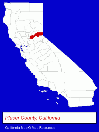
The California counties map at upper right shows Placer County, highlighted in red. Use the menu below to display interactive maps of Rocklin, either in a frame on this page or in full-screen mode.
Use the menu below to display categorized Rocklin directories.
| Rocklin Products and Services Directory | ||
|---|---|---|
| Air Conditioning | Animal Hospitals | Auto Service |
| Building Contractors | Cosmetic Dentists | Dentists |
| Home Improvement | Metals | Pediatrics Dentists |
| Restaurants | Veterinarians | |
Selected Rocklin, California Listings
These randomly selected Rocklin listings provide some insight into the city's cultural environment and economic climate.- Cabinet Dealers
- Cabinets & Cabinet Makers Residential
- Garage Organizers
- Auto Transmissions
- Cremation Services
- Emergency Services Dentists
- Metal Fabricators
- Sheet Metal Equipment & Supplies Wholesale & Manufacturers
- Attorneys
- Family Law Attorneys
- Divorce Attorneys
- Adoption Attorneys
- Custody & Support Law Attorneys
- Carpet, Rug & Upholstery Cleaning
- Carpet & Rug Dealers
- Building & Home Construction
- Building Contractors
- Auto Glass Retail
- Bathroom Planning & Remodeling
- Animal Health
- Small Animal Veterinarians
- Surgery Veterinarians
- Government Contractors
- Air Conditioning Contractors
- Building & Home Construction
- Building Contractors
- Government Contractors
- Building Materials & Supplies Wholesale & Manufacturers
Nearby California Cities and Towns *
- Citrus Heights (5) - Citrus Heights, California demographics and maps.
- El Dorado Hills (2) - El Dorado Hills, California information and maps.
- Folsom (11) - Folsom, California demographics and directory.
- Loomis (3) - Loomis, California information and maps.
- North Highlands (2) - North Highlands, California information and maps.
- Orangevale (2) - Orangevale, California information and maps.
- Roseville (30) - Roseville, California solutions directory and maps.
* Parenthesized numbers indicate economic activity levels.
Copyright © 2011-2026 RegionalDirectory.us. All rights reserved.