San Luis Obispo, California Map and Directory
Regional Directory > States Menu > California
 According to the United States Census Bureau, San Luis Obispo is a City that is located in San Luis Obispo County, California at 35.28 degrees North and 120.66 degrees West.
The city's time zone is America/Los Angeles, and the city's primary telephone area code is 805.
The land area of San Luis Obispo is about 13.13 square miles, whereas the water area of the city is about 0.15 square miles.
San Luis Obispo County's land area is about 3,299 square miles, so the city occupies about 0.4 percent of the county's total land area.
According to the United States Census Bureau, San Luis Obispo is a City that is located in San Luis Obispo County, California at 35.28 degrees North and 120.66 degrees West.
The city's time zone is America/Los Angeles, and the city's primary telephone area code is 805.
The land area of San Luis Obispo is about 13.13 square miles, whereas the water area of the city is about 0.15 square miles.
San Luis Obispo County's land area is about 3,299 square miles, so the city occupies about 0.4 percent of the county's total land area.
The Census Bureau estimates that San Luis Obispo had about 47,459 residents in 2019, which is approximately 3,615 people per square mile of land area.
According to recent American Community Survey data, the median household income in San Luis Obispo was about $56,071 per year.
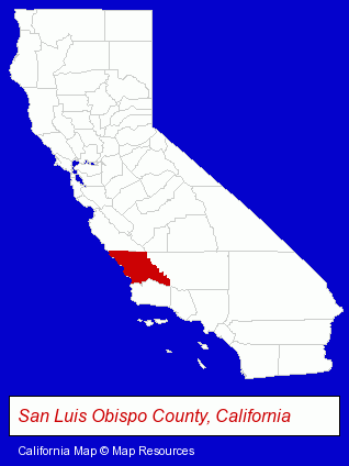
The California counties map at upper right shows San Luis Obispo County, highlighted in red. Use the menu below to display interactive maps of San Luis Obispo, either in a frame on this page or in full-screen mode.
Use the menu below to display categorized San Luis Obispo directories.
Selected San Luis Obispo, California Listings
These randomly selected San Luis Obispo listings provide some insight into the city's cultural environment and economic climate.- Concrete & Concrete Products Dealers
- Water Filtration Equipment Retail
- Spa & Hot Tub Service & Repair
- Insurance
- Estate Planning & Administration Attorneys
- Real Estate Attorneys
- Bicycle Dealers
- Motorcycle, Motor Scooter & ATV Service & Repair
- Publishers
- Newspaper Publishers
- Television Stations
- Newspaper Feature Syndicates
- Engineers
- Mechanical Engineers
- Aerospace
- Aerospace Engineers
- Builders & Contractors
- Building Contractors
- Bars & Pubs
- Agricultural Consultants
- Agricultural Engineers
- Marketing & Public Relations
- Phone Communications Services
- Communications & Public Relations Consultants
- Telecommunications Services
- Building & Home Construction
- Engineers
- Architects
- Architectural Services
- Mechanical Engineers
- Public Schools
- Colleges & Universities
- Adult & Continuing Education
- Grocery Stores & Supermarkets
- Food Products Wholesale & Manufacturers
Nearby California Cities and Towns *
- Arroyo Grande (3) - Arroyo Grande, California information and maps.
- Atascadero (4) - Atascadero, California information and maps.
- Morro Bay (2) - Morro Bay, California information and maps.
- Pismo Beach (5) - Pismo Beach, California demographics and maps.
- Santa Barbara (39) - Santa Barbara, California products & services directory.
- Santa Maria (7) - Santa Maria, California demographics and maps.
- Templeton (1) - Templeton, California information and maps.
* Parenthesized numbers indicate economic activity levels.
Copyright © 2011-2026 RegionalDirectory.us. All rights reserved.