Templeton, California Map and Directory
Regional Directory > States Menu > California
 According to the United States Census Bureau, Templeton is a Census-designated Place that is located in San Luis Obispo County, California at 35.55 degrees North and 120.71 degrees West.
The place's time zone is America/Los Angeles, and the place's primary telephone area code is 805.
The land area of Templeton is about 7.89 square miles, whereas the water area of the place is about 0.00 square miles.
San Luis Obispo County's land area is about 3,299 square miles, so the place occupies about 0.2 percent of the county's total land area.
According to the United States Census Bureau, Templeton is a Census-designated Place that is located in San Luis Obispo County, California at 35.55 degrees North and 120.71 degrees West.
The place's time zone is America/Los Angeles, and the place's primary telephone area code is 805.
The land area of Templeton is about 7.89 square miles, whereas the water area of the place is about 0.00 square miles.
San Luis Obispo County's land area is about 3,299 square miles, so the place occupies about 0.2 percent of the county's total land area.
The Census Bureau estimates that Templeton had about 7,838 residents in 2019, which is approximately 993 people per square mile of land area.
According to recent American Community Survey data, the median household income in Templeton was about $82,237 per year.
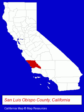
The California counties map at upper right shows San Luis Obispo County, highlighted in red. Use the menu below to display interactive maps of Templeton, either in a frame on this page or in full-screen mode.
Use the menu below to display categorized Templeton directories.
| Templeton Directory Page: | Physicians |
|---|
Selected Templeton, California Listings
These Templeton listings provide some insight into the place's cultural environment and economic climate.- Osteopathic Physicians & Surgeons
- Family & General Practice Physicians & Surgeons
- Cosmetic & Reconstructive Surgeons
- Surgeons
- Otolaryngology Physicians & Surgeons
- Cosmetic & Reconstructive Surgeons
- Surgeons
- Otolaryngology Physicians & Surgeons
- Musical Instruments Retail
- Guitars
- Pediatrics Physicians & Surgeons
- Veterinarians
- Pet Related Services
- Veterinary Equipment & Supplies
- Animal Shelters
- Humane Societies
- Cleaning Services
- Building Materials & Supplies Wholesale & Manufacturers
- Closet Accessories Wholesale & Manufacturers
- Radiology Physicians & Surgeons
- Medical Diagnostic Services
- Medical Imaging
- Moving & Storage
- Household Goods & Furniture Storage
- Moving & Storage Equipment & Supplies Retail
- Mini & Self Storage
Nearby California Cities and Towns *
- Arroyo Grande (3) - Arroyo Grande, California information and maps.
- Atascadero (4) - Atascadero, California information and maps.
- Cambria (3) - Cambria, California information and maps.
- Morro Bay (2) - Morro Bay, California information and maps.
- Pismo Beach (5) - Pismo Beach, California demographics and maps.
- San Luis Obispo (30) - San Luis Obispo, California solutions directory and maps.
- Santa Maria (7) - Santa Maria, California demographics and maps.
* Parenthesized numbers indicate economic activity levels.
Copyright © 2011-2026 RegionalDirectory.us. All rights reserved.