Arvada, Colorado Map and Directory
Regional Directory > States Menu > Colorado
 According to the United States Census Bureau, Arvada is a City that is located primarily in Jefferson County, Colorado at 39.83 degrees North and 105.15 degrees West.
The city's time zone is America/Denver, and the city's primary telephone area code is 303.
The land area of Arvada is about 38.33 square miles, whereas the water area of the city is about 0.62 square miles.
According to the United States Census Bureau, Arvada is a City that is located primarily in Jefferson County, Colorado at 39.83 degrees North and 105.15 degrees West.
The city's time zone is America/Denver, and the city's primary telephone area code is 303.
The land area of Arvada is about 38.33 square miles, whereas the water area of the city is about 0.62 square miles.
The Census Bureau estimates that Arvada had about 121,272 residents in 2019, which is approximately 3,164 people per square mile of land area.
According to recent American Community Survey data, the median household income in Arvada was about $84,717 per year.
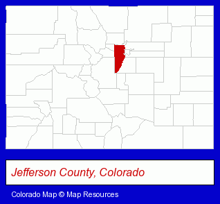
The Colorado counties map at upper right shows Jefferson County, highlighted in red. Use the menu below to display interactive maps of Arvada, either in a frame on this page or in full-screen mode.
Use the menu below to display categorized Arvada directories.
| Arvada Products and Services Directory | ||
|---|---|---|
| Accountants | Auto Service | Building Materials |
| Clinics | Clothing Stores | Dentists |
| Excavation Contractors | Home Improvement | Information Technology |
| Metals | Printing and Publishing | Schools |
| Veterinarians | ||
Selected Arvada, Colorado Listings
These randomly selected Arvada listings in 80002 provide a window into the city's cultural environment and economic climate. Advanced Surface Technologies- Metal Finishing
- Major Appliance Dealers
- Major Appliance Service & Repair
- Appliance Dealers
- Endodontics Dentists
- Podiatry Physicians & Surgeons
- Podiatry Information & Referral Services
- Security Systems & Services
- Alarm System Dealers
- Fire Alarm Sales & Service
- Colleges & Universities
- Industrial Equipment & Supplies Dealers
- Construction Machinery & Equipment Wholesale & Manufacturers
- Printing Equipment & Supplies Dealers
- Engineers
- Engineering Services
- Structural Steel Detailers
Nearby Colorado Cities and Towns *
- Broomfield (9) - Broomfield, Colorado demographics and directory.
- Denver (144) - Denver, Colorado products & services directory.
- Golden (7) - Golden, Colorado demographics and maps.
- Lafayette (6) - Lafayette, Colorado demographics and maps.
- Louisville (7) - Louisville, Colorado demographics and maps.
- Westminster (2) - Westminster, Colorado information and maps.
- Wheat Ridge (3) - Wheat Ridge, Colorado information and maps.
Large and Mid-size Cities in Nearby States
- Cheyenne, Wyoming (11) - Cheyenne, WY demographics and maps.
* Parenthesized numbers indicate economic activity levels.
Copyright © 2011-2026 RegionalDirectory.us. All rights reserved.