Boulder, Colorado Map and Directory
Regional Directory > States Menu > Colorado
 According to the United States Census Bureau, Boulder is a City that is located in Boulder County, Colorado at 40.01 degrees North and 105.27 degrees West.
The city's time zone is America/Denver, and the city's primary telephone area code is 303.
The land area of Boulder is about 24.86 square miles, whereas the water area of the city is about 1.02 square miles.
Boulder County's land area is about 726 square miles, so the city occupies about 3.4 percent of the county's total land area.
According to the United States Census Bureau, Boulder is a City that is located in Boulder County, Colorado at 40.01 degrees North and 105.27 degrees West.
The city's time zone is America/Denver, and the city's primary telephone area code is 303.
The land area of Boulder is about 24.86 square miles, whereas the water area of the city is about 1.02 square miles.
Boulder County's land area is about 726 square miles, so the city occupies about 3.4 percent of the county's total land area.
The Census Bureau estimates that Boulder had about 105,673 residents in 2019, which is approximately 4,251 people per square mile of land area.
According to recent American Community Survey data, the median household income in Boulder was about $69,520 per year. This Boulder Real Estate directory lists real estate solution providers in Boulder, Colorado.
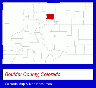
The Colorado counties map at upper right shows Boulder County, highlighted in red. Use the menu below to display interactive maps of Boulder, either in a frame on this page or in full-screen mode.
Use the menu below to display categorized Boulder directories.
Selected Boulder, Colorado Listings
These randomly selected Boulder listings provide some insight into the city's cultural environment and economic climate.- Laboratories
- Research & Development Laboratories
- Crafts & Craft Supplies Retail
- Housewares Wholesale & Manufacturers
- Hand Blown Glass Retail
- Art Galleries & Dealers
- Real Estate Commercial & Industrial
- Real Estate Investments
- Civic Clubs & Organizations
- Sports & Recreation Clubs & Organizations
- Private Golf Courses
- Bars & Pubs
- Sports Bars
- Computer Software
- Bicycle Repair & Maintenance
- Bicycle Rental
- Building & Home Construction
- Metals
- Architects
- Architectural Services
- Engineers
- Civil Engineers
- Structural Engineers
- Computer Software
- GPS Navigation & Tracking
- Industrial Equipment & Supplies Dealers
- Bottled & Bulk Water Retail
- Beverage Dispensing Equipment, Supplies & Repair
- Water Coolers Retail
- Clothing & Accessories Retail
- Clothing & Accessories Wholesale & Manufacturers
- Criminal Law Attorneys
- DUI and DWI Attorneys
- Drug Charge Attorneys
- Building & Home Construction
- Architects
- Architectural Services
- Furniture Stores
- Resale, Second Hand & Used Merchandise Stores
- Used Furniture Dealers
- Computer & Equipment Dealers
- Computer Consultants
- Consumer Electronics Stores
- Computer Systems Consultants & Designers
- Social & Human Services
- Clinics & Medical Centers
- Residential Care Facilities
- Used Cars
- Used Trucks
- Building Contractors
- Architects
- Architectural Engineers
- Office Supplies Retail
- Office Furniture & Equipment Dealers
- Stationery Retail
- Maxillofacial Physicians & Surgeons
Nearby Colorado Cities and Towns *
- Arvada (13) - Arvada, Colorado demographics and directory.
- Broomfield (9) - Broomfield, Colorado demographics and directory.
- Golden (7) - Golden, Colorado demographics and maps.
- Lafayette (6) - Lafayette, Colorado demographics and maps.
- Longmont (19) - Longmont, Colorado solutions directory and maps.
- Louisville (7) - Louisville, Colorado demographics and maps.
- Westminster (2) - Westminster, Colorado information and maps.
Large and Mid-size Cities in Nearby States
- Cheyenne, Wyoming (11) - Cheyenne, WY demographics and maps.
* Parenthesized numbers indicate economic activity levels.
Copyright © 2011-2026 RegionalDirectory.us. All rights reserved.