Glenwood Springs, Colorado Map and Directory
Regional Directory > States Menu > Colorado
 According to the United States Census Bureau, Glenwood Springs is a City that is located in Garfield County, Colorado at 39.55 degrees North and 107.32 degrees West.
The city's time zone is America/Denver, and the city's primary telephone area code is 970.
The land area of Glenwood Springs is about 5.69 square miles, whereas the water area of the city is about 0.01 square miles.
Garfield County's land area is about 2,948 square miles, so the city occupies about 0.2 percent of the county's total land area.
According to the United States Census Bureau, Glenwood Springs is a City that is located in Garfield County, Colorado at 39.55 degrees North and 107.32 degrees West.
The city's time zone is America/Denver, and the city's primary telephone area code is 970.
The land area of Glenwood Springs is about 5.69 square miles, whereas the water area of the city is about 0.01 square miles.
Garfield County's land area is about 2,948 square miles, so the city occupies about 0.2 percent of the county's total land area.
The Census Bureau estimates that Glenwood Springs had about 9,930 residents in 2019, which is approximately 1,745 people per square mile of land area.
According to recent American Community Survey data, the median household income in Glenwood Springs was about $66,693 per year.
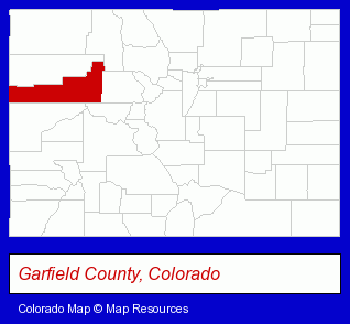
The Colorado counties map at upper right shows Garfield County, highlighted in red. Use the menu below to display interactive maps of Glenwood Springs, either in a frame on this page or in full-screen mode.
Use the menu below to display categorized Glenwood Springs directories.
| Glenwood Springs Products and Services Directory | ||
|---|---|---|
| Attorneys | Home Improvement | Hotels |
Selected Glenwood Springs, Colorado Listings
These representative Glenwood Springs listings provide some insight into the city's cultural environment and economic climate.- Computer Networks
- Stereo Equipment Dealers
- Pet Care Services
- Animal Shelters
- Interior Decorators & Designers
- Chambers of Commerce
- Professional & Trade Associations
- Charitable & Nonprofit Organizations
- Adult & Continuing Education
- Self Improvement & Motivational Schools
- Reading Improvement Instruction
- Engineers
- Civil Engineers
- Structural Engineers
- Engineers
- Consulting Engineers
- Civil Engineers
- Construction Engineers
- Water Supply Engineers
- Homes & Residential Real Estate
- General Real Estate
- Property Management
- Real Estate Commercial & Industrial
- Real Estate Investments
- Asian Restaurants
Nearby Colorado Cities and Towns *
- Aspen (9) - Aspen, Colorado demographics and directory.
- Avon (5) - Avon, Colorado demographics and maps.
- Basalt (1) - Basalt, Colorado information and maps.
- Carbondale (2) - Carbondale, Colorado information and maps.
- Edwards (2) - Edwards, Colorado information and maps.
- Gypsum (2) - Gypsum, Colorado information and maps.
- Snowmass Village (1) - Snowmass Village, Colorado information and maps.
* Parenthesized numbers indicate economic activity levels.
Copyright © 2011-2026 RegionalDirectory.us. All rights reserved.