Carbondale, Colorado Map and Directory
Regional Directory > States Menu > Colorado
 According to the United States Census Bureau, Carbondale is a Town that is located in Garfield County, Colorado at 39.40 degrees North and 107.21 degrees West.
The town's time zone is America/Denver, and the town's primary telephone area code is 970.
The land area of Carbondale is about 2.04 square miles, whereas the water area of the town is about 0.00 square miles.
Garfield County's land area is about 2,948 square miles, so the town occupies about 0.1 percent of the county's total land area.
According to the United States Census Bureau, Carbondale is a Town that is located in Garfield County, Colorado at 39.40 degrees North and 107.21 degrees West.
The town's time zone is America/Denver, and the town's primary telephone area code is 970.
The land area of Carbondale is about 2.04 square miles, whereas the water area of the town is about 0.00 square miles.
Garfield County's land area is about 2,948 square miles, so the town occupies about 0.1 percent of the county's total land area.
The Census Bureau estimates that Carbondale had about 6,898 residents in 2019, which is approximately 3,381 people per square mile of land area.
According to recent American Community Survey data, the median household income in Carbondale was about $81,012 per year.
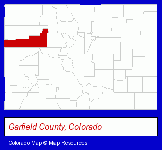
The Colorado counties map at upper right shows Garfield County, highlighted in red. Use the menu below to display interactive maps of Carbondale, either in a frame on this page or in full-screen mode.
Use the menu below to display categorized Carbondale directories.
| Carbondale Products and Services Directory | |
|---|---|
| Building Materials | Home Improvement |
Selected Carbondale, Colorado Listings
These representative Carbondale listings provide some insight into the town's cultural environment and economic climate.- Building & Home Construction
- Building Materials & Supplies Dealers
- Cabinet Dealers
- Cabinets & Cabinet Makers Residential
- Ship Building & Repair
- Building & Home Construction
- Architects
- Architectural Services
- Radio Stations
- Information Technology Services
- Internet Products & Services
- Computers & Equipment Repair & Maintenance
- Web Sites
- Auto Parts Retail
- Machine Shops
- CNC Machining, Turning & Milling Shops
- Truck Equipment, Parts & Accessories Retail
- Restaurants
- Thai Restaurants
- Sports & Recreation Facilities
- Recreation Centers
- Video Equipment, Parts & Supplies Retail
- Audiovisual Equipment Service & Repair
- Moving & Storage
- Household Goods & Furniture Storage
- Household Goods Moving & Storage
- Warehouses & Warehousing
- Commodity & Merchandise Warehouses
- Energy & Environment
- Solar Energy Systems & Services Retail
Nearby Colorado Cities and Towns *
- Aspen (9) - Aspen, Colorado demographics and directory.
- Basalt (1) - Basalt, Colorado information and maps.
- Crested Butte (1) - Crested Butte, Colorado information and maps.
- Edwards (2) - Edwards, Colorado information and maps.
- Glenwood Springs (3) - Glenwood Springs, Colorado information and maps.
- Gypsum (2) - Gypsum, Colorado information and maps.
- Snowmass Village (1) - Snowmass Village, Colorado information and maps.
* Parenthesized numbers indicate economic activity levels.
Copyright © 2011-2026 RegionalDirectory.us. All rights reserved.