La Junta, Colorado Map and Directory
Regional Directory > States Menu > Colorado
 According to the United States Census Bureau, La Junta is a City that is located in Otero County, Colorado at 37.99 degrees North and 103.54 degrees West.
The city's time zone is America/Denver, and the city's primary telephone area code is 719.
The land area of La Junta is about 3.02 square miles, whereas the water area of the city is about 0.01 square miles.
Otero County's land area is about 1,262 square miles, so the city occupies about 0.2 percent of the county's total land area.
According to the United States Census Bureau, La Junta is a City that is located in Otero County, Colorado at 37.99 degrees North and 103.54 degrees West.
The city's time zone is America/Denver, and the city's primary telephone area code is 719.
The land area of La Junta is about 3.02 square miles, whereas the water area of the city is about 0.01 square miles.
Otero County's land area is about 1,262 square miles, so the city occupies about 0.2 percent of the county's total land area.
The Census Bureau estimates that La Junta had about 6,881 residents in 2019, which is approximately 2,278 people per square mile of land area.
According to recent American Community Survey data, the median household income in La Junta was about $39,567 per year.
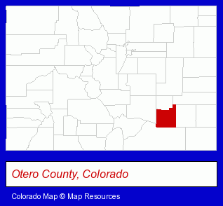
The Colorado counties map at upper right shows Otero County, highlighted in red. Use the menu below to display interactive maps of La Junta, either in a frame on this page or in full-screen mode.
Use the menu below to display categorized La Junta directories.
| La Junta Directory Page: | Printing and Publishing |
|---|
Selected La Junta, Colorado Listings
These La Junta listings provide some insight into the city's cultural environment and economic climate. First National Bank- Banks
- Grocery Stores & Supermarkets
- Food Products Wholesale & Manufacturers
- Canners & Food Processors
- Condiments & Sauces Wholesale & Manufacturers
- Condiments & Sauces Retail
- Utilities
- Electric Companies
- Financial Services
- Banks
- Personal Loans
- Personal Financial Services
- Agricultural Equipment & Supplies Retail
- Farm Equipment & Supplies Dealers
- Animal Feed
Nearby Colorado Cities and Towns *
- Colorado Springs (62) - Colorado Springs, Colorado products & services directory.
- Manitou Springs (2) - Manitou Springs, Colorado information and maps.
- Pueblo (9) - Pueblo, Colorado demographics and directory.
* Parenthesized numbers indicate economic activity levels.
Copyright © 2011-2026 RegionalDirectory.us. All rights reserved.