Pueblo, Colorado Map and Directory
Regional Directory > States Menu > Colorado
 According to the United States Census Bureau, Pueblo is a City that is located in Pueblo County, Colorado at 38.25 degrees North and 104.61 degrees West.
The city's time zone is America/Denver, and the city's primary telephone area code is 719.
The land area of Pueblo is about 53.59 square miles, whereas the water area of the city is about 0.79 square miles.
Pueblo County's land area is about 2,386 square miles, so the city occupies about 2.2 percent of the county's total land area.
According to the United States Census Bureau, Pueblo is a City that is located in Pueblo County, Colorado at 38.25 degrees North and 104.61 degrees West.
The city's time zone is America/Denver, and the city's primary telephone area code is 719.
The land area of Pueblo is about 53.59 square miles, whereas the water area of the city is about 0.79 square miles.
Pueblo County's land area is about 2,386 square miles, so the city occupies about 2.2 percent of the county's total land area.
The Census Bureau estimates that Pueblo had about 112,361 residents in 2019, which is approximately 2,097 people per square mile of land area.
According to recent American Community Survey data, the median household income in Pueblo was about $40,450 per year.
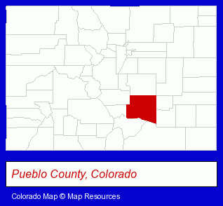
The Colorado counties map at upper right shows Pueblo County, highlighted in red. Use the menu below to display interactive maps of Pueblo, either in a frame on this page or in full-screen mode.
Use the menu below to display categorized Pueblo directories.
| Pueblo Products and Services Directory | ||
|---|---|---|
| Attorneys | Banks | Business Services |
| Credit Unions | Home Improvement | Landscape Contractors |
| Printing and Publishing | Schools | Water Utility Companies |
Selected Pueblo, Colorado Listings
These randomly selected Pueblo listings provide some insight into the city's cultural environment and economic climate.- Persons with Disabilities Organizations
- Persons With Disabilities Assistance Services
- Disabilities & Special Needs Equipment & Supplies Retail
- Disabilities & Special Needs Equipment & Supplies
- Utilities
- Water & Sewage Companies
- Water Utility Companies
- Radio Sales & Service
- Televisions Retail
- Television Service & Repair
- Accountants
- Public Accountants
- Certified Public Accountants
- Landscape Services
- Lawn & Garden Sprinklers Installation & Service
- Lawn & Garden Equipment Service & Repair
- Grocery Stores & Supermarkets
- Bakeries
- Fruits & Vegetables Retail
- Excavation Contractors
- Beauty Salons
- Hair Care & Treatment
- Beauticians
- Pest Control Services
- Bee Control & Removal Services
- Excavation Contractors
- Air Transportation
- Ambulance Services
- Emergency Ambulance Services
- Aircraft Charter, Rental & Leasing
Nearby Colorado Cities and Towns *
- Canon City (2) - Canon City, Colorado information and maps.
- Castle Rock (8) - Castle Rock, Colorado demographics and maps.
- Colorado Springs (62) - Colorado Springs, Colorado products & services directory.
- Englewood (33) - Englewood, Colorado products & services directory.
- Littleton (30) - Littleton, Colorado solutions directory and maps.
- Manitou Springs (2) - Manitou Springs, Colorado information and maps.
- Parker (5) - Parker, Colorado demographics and maps.
* Parenthesized numbers indicate economic activity levels.
Copyright © 2011-2026 RegionalDirectory.us. All rights reserved.