Pagosa Springs, Colorado Map and Directory
Regional Directory > States Menu > Colorado
 According to the United States Census Bureau, Pagosa Springs is a Town that is located in Archuleta County, Colorado at 37.27 degrees North and 107.01 degrees West.
The town's time zone is America/Denver, and the town's primary telephone area code is 970.
The land area of Pagosa Springs is about 4.87 square miles, whereas the water area of the town is about 0.03 square miles.
Archuleta County's land area is about 1,350 square miles, so the town occupies about 0.4 percent of the county's total land area.
According to the United States Census Bureau, Pagosa Springs is a Town that is located in Archuleta County, Colorado at 37.27 degrees North and 107.01 degrees West.
The town's time zone is America/Denver, and the town's primary telephone area code is 970.
The land area of Pagosa Springs is about 4.87 square miles, whereas the water area of the town is about 0.03 square miles.
Archuleta County's land area is about 1,350 square miles, so the town occupies about 0.4 percent of the county's total land area.
The Census Bureau estimates that Pagosa Springs had about 1,743 residents in 2014, which is approximately 358 people per square mile of land area.
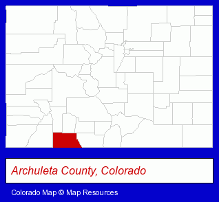
The Colorado counties map at upper right shows Archuleta County, highlighted in red. Use the menu below to display interactive maps of Pagosa Springs, either in a frame on this page or in full-screen mode.
Use the menu below to display categorized Pagosa Springs directories.
| Pagosa Springs Directory Page: | Hotels |
|---|
Selected Pagosa Springs, Colorado Listings
These Pagosa Springs listings provide some insight into the town's cultural environment and economic climate. Abraham Solar-The Power Broker- Building & Home Construction
- Energy & Environment
- Solar Energy Systems & Services Retail
- Boarding Stables
- Equestrian Sports & Recreation
- Horseback Riding
- Gift Shops
- Lodging
- Hotels
- Motels
- Clinics & Medical Centers
- Home Health Care
- Hospice Services
- Optometrists
Nearby Colorado Cities and Towns *
- Durango (17) - Durango, Colorado solutions directory and maps.
- Montrose (6) - Montrose, Colorado demographics and maps.
- Telluride (2) - Telluride, Colorado information and maps.
* Parenthesized numbers indicate economic activity levels.
Copyright © 2011-2026 RegionalDirectory.us. All rights reserved.