Montrose, Colorado Map and Directory
Regional Directory > States Menu > Colorado
 According to the United States Census Bureau, Montrose is a City that is located in Montrose County, Colorado at 38.48 degrees North and 107.88 degrees West.
The city's time zone is America/Denver, and the city's primary telephone area code is 970.
The land area of Montrose is about 17.88 square miles, whereas the water area of the city is about 0.00 square miles.
Montrose County's land area is about 2,241 square miles, so the city occupies about 0.8 percent of the county's total land area.
According to the United States Census Bureau, Montrose is a City that is located in Montrose County, Colorado at 38.48 degrees North and 107.88 degrees West.
The city's time zone is America/Denver, and the city's primary telephone area code is 970.
The land area of Montrose is about 17.88 square miles, whereas the water area of the city is about 0.00 square miles.
Montrose County's land area is about 2,241 square miles, so the city occupies about 0.8 percent of the county's total land area.
The Census Bureau estimates that Montrose had about 19,782 residents in 2019, which is approximately 1,106 people per square mile of land area.
According to recent American Community Survey data, the median household income in Montrose was about $46,250 per year.
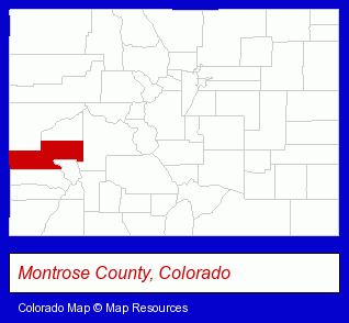
The Colorado counties map at upper right shows Montrose County, highlighted in red. Use the menu below to display interactive maps of Montrose, either in a frame on this page or in full-screen mode.
Use the menu below to display categorized Montrose directories.
| Montrose Products and Services Directory | ||
|---|---|---|
| Auto Service | Building Materials | Business Services |
| Chiropractors | Dentists | Home Improvement |
Selected Montrose, Colorado Listings
These randomly selected Montrose listings provide some insight into the city's cultural environment and economic climate.- Door & Door Frame Dealers
- Employment
- Human Resources
- Employment Preparation Services
- Career & Vocational Counseling
- Vocational Education
- Aircraft Parts & Equipment Retail
- Aviation Schools
- Aircraft Instruments
- Medical Equipment & Supplies Retail
- Sign Dealers
- Signs Wholesale & Manufacturers
- Commercial Signs
- Public Golf Courses
- Private Golf Courses
- Private Golf Clubs
- Optometrists
- Optical Goods Retail
- Contact Lenses Retail
- Auctions
- Auctioneers & Auction Houses
- Libraries
- Mortgages
- Financial Institutions
- Credit Unions
- Personal Loans
- Industrial Equipment Rebuilding, Service & Repair
- Machine Shops
- Auto Machine Shop Services
- Auto Engine Service & Repair
- Utilities
- Water & Sewage Companies
- Water Utility Companies
- Building Materials & Supplies Wholesale & Manufacturers
- Commercial & Industrial Building Materials & Supplies
- General Practice
- Orthopedics Physicians & Surgeons
- Sports Medicine Physicians & Surgeons
Nearby Colorado Cities and Towns *
- Crested Butte (1) - Crested Butte, Colorado information and maps.
- Durango (17) - Durango, Colorado solutions directory and maps.
- Grand Junction (18) - Grand Junction, Colorado solutions directory and maps.
- Gunnison (1) - Gunnison, Colorado information and maps.
- Ouray (1) - Ouray, Colorado information and maps.
- Silverton (1) - Silverton, Colorado information and maps.
- Telluride (2) - Telluride, Colorado information and maps.
* Parenthesized numbers indicate economic activity levels.
Copyright © 2011-2026 RegionalDirectory.us. All rights reserved.