Salida, Colorado Map and Directory
Regional Directory > States Menu > Colorado
 According to the United States Census Bureau, Salida is a City that is located in Chaffee County, Colorado at 38.53 degrees North and 106.00 degrees West.
The city's time zone is America/Denver, and the city's primary telephone area code is 719.
The land area of Salida is about 2.59 square miles, whereas the water area of the city is about 0.00 square miles.
Chaffee County's land area is about 1,013 square miles, so the city occupies about 0.3 percent of the county's total land area.
According to the United States Census Bureau, Salida is a City that is located in Chaffee County, Colorado at 38.53 degrees North and 106.00 degrees West.
The city's time zone is America/Denver, and the city's primary telephone area code is 719.
The land area of Salida is about 2.59 square miles, whereas the water area of the city is about 0.00 square miles.
Chaffee County's land area is about 1,013 square miles, so the city occupies about 0.3 percent of the county's total land area.
The Census Bureau estimates that Salida had about 6,082 residents in 2019, which is approximately 2,348 people per square mile of land area.
According to recent American Community Survey data, the median household income in Salida was about $46,875 per year.
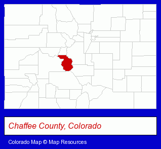
The Colorado counties map at upper right shows Chaffee County, highlighted in red. Use the menu below to display interactive maps of Salida, either in a frame on this page or in full-screen mode.
Use the menu below to display categorized Salida directories.
| Salida Products and Services Directory | ||
|---|---|---|
| Home Improvement | Hotels | Visual Arts |
Selected Salida, Colorado Listings
These representative Salida listings provide some insight into the city's cultural environment and economic climate.- Truck Dealers
- Used Cars
- Used Trucks
- Auto Rental
- Information Technology Services
- Computer Consultants
- Computer Systems Consultants & Designers
- Art Galleries & Dealers
- Antiques
- Antique Dealers
- Picture Frames Retail
- Tours & Charters
- Fishing
- Raft Trips & Tours
- Fishing Expeditions
- Engineers
- Civil Engineers
- Construction Engineers
- Geotechnical Engineers
- Geological Engineers
- Art Galleries & Dealers
- Art Galleries & Dealers
- Public Golf Courses
- Sports & Recreation Clubs & Organizations
- Private Golf Courses
- Golf Driving & Practice Ranges
- Sporting Goods Dealers
- Ski Shops
Nearby Colorado Cities and Towns *
- Aspen (9) - Aspen, Colorado demographics and directory.
- Breckenridge (4) - Breckenridge, Colorado information and maps.
- Canon City (2) - Canon City, Colorado information and maps.
- Gunnison (1) - Gunnison, Colorado information and maps.
* Parenthesized numbers indicate economic activity levels.
Copyright © 2011-2026 RegionalDirectory.us. All rights reserved.