Shelton, Connecticut Map and Directory
Regional Directory > States Menu > Connecticut
 According to the United States Census Bureau, Shelton is a City that is located in Fairfield County, Connecticut at 41.32 degrees North and 73.09 degrees West.
The city's time zone is America/New York, and the city's primary telephone area code is 203.
The land area of Shelton is about 30.63 square miles, whereas the water area of the city is about 1.28 square miles.
Fairfield County's land area is about 625 square miles, so the city occupies about 4.9 percent of the county's total land area.
According to the United States Census Bureau, Shelton is a City that is located in Fairfield County, Connecticut at 41.32 degrees North and 73.09 degrees West.
The city's time zone is America/New York, and the city's primary telephone area code is 203.
The land area of Shelton is about 30.63 square miles, whereas the water area of the city is about 1.28 square miles.
Fairfield County's land area is about 625 square miles, so the city occupies about 4.9 percent of the county's total land area.
The Census Bureau estimates that Shelton had about 41,129 residents in 2019, which is approximately 1,343 people per square mile of land area.
According to recent American Community Survey data, the median household income in Shelton was about $97,131 per year.
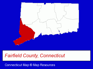
The Connecticut counties map at upper right shows Fairfield County, highlighted in red. Use the menu below to display interactive maps of Shelton, either in a frame on this page or in full-screen mode.
Use the menu below to display categorized Shelton directories.
| Shelton Products and Services Directory | ||
|---|---|---|
| Building Materials | Business Services | Home Improvement |
| Information Technology | ||
Selected Shelton, Connecticut Listings
These randomly selected Shelton listings provide some insight into the city's cultural environment and economic climate.- Audio Equipment & Supplies Dealers
- Stereo Equipment Dealers
- Audiovisual Equipment Service & Repair
- Stereo Equipment Parts & Supplies Dealers
- Metals
- Metal Products
- Metal Products Wholesale & Manufacturers
- Metal Products Dealers
- Home Improvement Stores
- Hardware Dealers
- Internet Products & Services
- Internet Services
- Internet Service Providers
- Physicians & Surgeons
- Accountants
- Public Accountants
- Certified Public Accountants
- Floors & Flooring Retail
- Wood & Laminate Flooring
- Adhesives & Glues
- Adhesive & Glues Wholesale & Manufacturers
- Moving & Storage
- Household Goods & Furniture Storage
- Household Goods Moving & Storage
- Mini & Self Storage
- Social & Human Services
- Mental Health
- Counseling Services
- Marriage & Family Counseling
- Counseling Centers
- Building Materials & Supplies Wholesale & Manufacturers
- HVAC Equipment & Supplies Dealers
- Plumbing & Heating Supplies Retail
- Heating Equipment Parts & Supplies Dealers
Nearby Connecticut Cities and Towns *
- Bridgeport (10) - Bridgeport, Connecticut demographics and directory.
- Hamden (11) - Hamden, Connecticut demographics and directory.
- Milford (14) - Milford, Connecticut demographics and directory.
- Monroe (3) - Monroe, Connecticut information and maps.
- New Haven (14) - New Haven, Connecticut demographics and directory.
- Stratford (6) - Stratford, Connecticut demographics and maps.
- Trumbull (3) - Trumbull, Connecticut information and maps.
* Parenthesized numbers indicate economic activity levels.
Copyright © 2011-2026 RegionalDirectory.us. All rights reserved.