Stratford, Connecticut Map and Directory
Regional Directory > States Menu > Connecticut
 According to the United States Census Bureau, Stratford is a Town that is located in Fairfield County, Connecticut at 41.21 degrees North and 73.13 degrees West.
The town's time zone is America/New York, and the town's primary telephone area code is 203.
The land area of Stratford is about 17.49 square miles, whereas the water area of the town is about 2.43 square miles.
Fairfield County's land area is about 625 square miles, so the town occupies about 2.8 percent of the county's total land area.
According to the United States Census Bureau, Stratford is a Town that is located in Fairfield County, Connecticut at 41.21 degrees North and 73.13 degrees West.
The town's time zone is America/New York, and the town's primary telephone area code is 203.
The land area of Stratford is about 17.49 square miles, whereas the water area of the town is about 2.43 square miles.
Fairfield County's land area is about 625 square miles, so the town occupies about 2.8 percent of the county's total land area.
The Census Bureau estimates that Stratford had about 52,120 residents in 2019, which is approximately 2,980 people per square mile of land area.
According to recent American Community Survey data, the median household income in Stratford was about $79,430 per year.
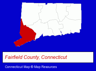
The Connecticut counties map at upper right shows Fairfield County, highlighted in red. Use the menu below to display interactive maps of Stratford, either in a frame on this page or in full-screen mode.
Use the menu below to display categorized Stratford directories.
| Stratford Products and Services Directory | ||
|---|---|---|
| Auto Service | Home Improvement | Metals |
| Restaurants | Schools | Steak Restaurants |
Selected Stratford, Connecticut Listings
These randomly selected Stratford listings provide some insight into the town's cultural environment and economic climate.- Endodontics Dentists
- Office Furniture & Equipment Dealers
- Mail Services & Package Shipping
- Office Furniture & Equipment Wholesale & Manufacturers
- Mailing Equipment & Supplies
- Postage Equipment & Service
- Pizza Restaurants
- Italian Restaurants
- Fine Dining Restaurants
- Land Surveyors
- Electric & Electronic Equipment & Supplies
- Electric Equipment & Supplies Dealers
- Exporters
- Electronic Equipment & Supplies Wholesale & Manufacturers
- Electric Control Equipment
- Machine Shops
- Aircraft Parts & Equipment Wholesale & Manufacturers
- Aircraft Painting, Service & Repair
- Clothing & Accessories Retail
- Jewelers
- Personal Loans
- Pawn Brokers & Shops
- Electronic Equipment & Supplies Wholesale & Manufacturers
- Audiovisual Equipment Service & Repair
- Industrial Equipment & Supplies Dealers
- Chemicals Wholesale & Manufacturers
- Construction Machinery & Equipment Dealers
- Concrete Construction Equipment & Supplies
- Elementary & Secondary Education
- Elementary Schools
- Private Schools
- Educational Services
- Pizza Restaurants
- Take Out
- Seafood Restaurants
- Family Restaurants
- Security Systems & Services
- Home Improvement Stores
- Hardware Dealers
Nearby Connecticut Cities and Towns *
- Bridgeport (10) - Bridgeport, Connecticut demographics and directory.
- Fairfield (8) - Fairfield, Connecticut demographics and maps.
- Milford (14) - Milford, Connecticut demographics and directory.
- Monroe (3) - Monroe, Connecticut information and maps.
- New Haven (14) - New Haven, Connecticut demographics and directory.
- Shelton (4) - Shelton, Connecticut information and maps.
- Trumbull (3) - Trumbull, Connecticut information and maps.
* Parenthesized numbers indicate economic activity levels.
Copyright © 2011-2026 RegionalDirectory.us. All rights reserved.