Stafford Springs, Connecticut Map and Directory
Regional Directory > States Menu > Connecticut
 According to the United States Census Bureau, Stafford Springs is a Census-designated Place that is located in Tolland County, Connecticut at 41.95 degrees North and 72.30 degrees West.
The place's time zone is America/New York, and the place's primary telephone area code is 959.
The land area of Stafford Springs is about 6.37 square miles, whereas the water area of the place is about 0.04 square miles.
Tolland County's land area is about 410 square miles, so the place occupies about 1.6 percent of the county's total land area.
According to the United States Census Bureau, Stafford Springs is a Census-designated Place that is located in Tolland County, Connecticut at 41.95 degrees North and 72.30 degrees West.
The place's time zone is America/New York, and the place's primary telephone area code is 959.
The land area of Stafford Springs is about 6.37 square miles, whereas the water area of the place is about 0.04 square miles.
Tolland County's land area is about 410 square miles, so the place occupies about 1.6 percent of the county's total land area.
The Census Bureau estimates that Stafford Springs had about 5,023 residents in 2019, which is approximately 789 people per square mile of land area.
According to recent American Community Survey data, the median household income in Stafford Springs was about $67,292 per year.
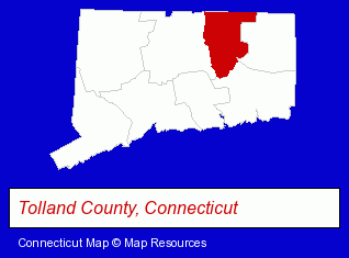
The Connecticut counties map at upper right shows Tolland County, highlighted in red. Use the menu below to display interactive maps of Stafford Springs, either in a frame on this page or in full-screen mode.
Use the menu below to display categorized Stafford Springs directories.
| Stafford Springs Directory Page: | Home Improvement |
|---|
Selected Stafford Springs, Connecticut Listings
These Stafford Springs listings provide some insight into the place's cultural environment and economic climate. Corktec- Building Materials & Supplies Dealers
- Home Improvement Stores
- Hardware Dealers
- Physicians & Surgeons
- Optometrists
- Plumbing Contractors
- Kitchen & Bathroom Remodeling
- Plumbing Service & Repair
- Sporting Goods Dealers
- Fishing Equipment & Supplies Dealers
- Fishing Bait & Tackle
- Fishing Supplies & Tackle Wholesale & Manufacturers
- Auto Racing
Nearby Connecticut Cities and Towns *
- East Hartford (4) - East Hartford, Connecticut information and maps.
- Enfield (4) - Enfield, Connecticut information and maps.
- Glastonbury (8) - Glastonbury, Connecticut demographics and maps.
- Hartford (16) - Hartford, Connecticut demographics and directory.
- Manchester (9) - Manchester, Connecticut demographics and directory.
- South Windsor (3) - South Windsor, Connecticut information and maps.
- Windsor (2) - Windsor, Connecticut information and maps.
* Parenthesized numbers indicate economic activity levels.
Copyright © 2011-2026 RegionalDirectory.us. All rights reserved.