East Hartford, Connecticut Map and Directory
Regional Directory > States Menu > Connecticut
 According to the United States Census Bureau, East Hartford is a Town that is located in Hartford County, Connecticut at 41.76 degrees North and 72.61 degrees West.
The town's time zone is America/New York, and the town's primary telephone area code is 959.
The land area of East Hartford is about 18.00 square miles, whereas the water area of the town is about 0.74 square miles.
Hartford County's land area is about 735 square miles, so the town occupies about 2.4 percent of the county's total land area.
According to the United States Census Bureau, East Hartford is a Town that is located in Hartford County, Connecticut at 41.76 degrees North and 72.61 degrees West.
The town's time zone is America/New York, and the town's primary telephone area code is 959.
The land area of East Hartford is about 18.00 square miles, whereas the water area of the town is about 0.74 square miles.
Hartford County's land area is about 735 square miles, so the town occupies about 2.4 percent of the county's total land area.
The Census Bureau estimates that East Hartford had about 50,272 residents in 2019, which is approximately 2,793 people per square mile of land area.
According to recent American Community Survey data, the median household income in East Hartford was about $55,967 per year.
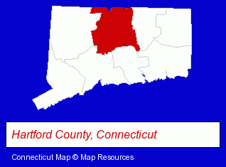
The Connecticut counties map at upper right shows Hartford County, highlighted in red. Use the menu below to display interactive maps of East Hartford, either in a frame on this page or in full-screen mode.
Use the menu below to display categorized East Hartford directories.
| East Hartford Products and Services Directory | ||
|---|---|---|
| Auto Service | Home Improvement | Metals |
| Visual Arts | ||
Selected East Hartford, Connecticut Listings
These randomly selected East Hartford listings provide some insight into the town's cultural environment and economic climate.- Auto & Truck Wrecking
- Auto Recycling & Dismantling
- Laboratories
- Research & Development Laboratories
- Insurance
- Information Technology Services
- Computer Software
- Computer & Equipment Dealers
- Computer & Software Stores
- Door & Window Dealers
- Windows & Parts Dealers
- Corporate Business Attorneys
- Employment & Labor Law Attorneys
- Arbitration & Mediation Services
- Arbitration & Mediation Services Attorneys
- Blind Organizations
- Metal Finishing
- Metal Polishing, Buffing & Plating
- Industrial Equipment & Supplies Dealers
- Industrial Equipment & Supplies Wholesale & Manufacturers
- Electric Equipment & Supplies Dealers
- Construction Machinery & Equipment Wholesale & Manufacturers
- Automation Equipment & Systems Dealers Industrial
- Photography
- Professional Photographers
- Photographers Commercial & Industrial
- Restaurants
- Pizza Restaurants
- Take Out
- Delicatessens
- Auto Body Repair & Painting
- Sign Dealers
- Commercial & Graphic Artists
- Commercial Signs
- Truck Body Repair & Painting
Nearby Connecticut Cities and Towns *
- Glastonbury (8) - Glastonbury, Connecticut demographics and maps.
- Hartford (16) - Hartford, Connecticut demographics and directory.
- Manchester (9) - Manchester, Connecticut demographics and directory.
- Newington (7) - Newington, Connecticut demographics and maps.
- Rocky Hill (5) - Rocky Hill, Connecticut demographics and maps.
- South Windsor (3) - South Windsor, Connecticut information and maps.
- West Hartford (11) - West Hartford, Connecticut demographics and directory.
Large and Mid-size Cities in Nearby States
- Springfield, Massachusetts (18) - Springfield, MA demographics and directory.
- Westfield, Massachusetts (5) - Westfield, MA information and maps.
* Parenthesized numbers indicate economic activity levels.
Copyright © 2011-2026 RegionalDirectory.us. All rights reserved.