West Hartford, Connecticut Map and Directory
Regional Directory > States Menu > Connecticut
 According to the United States Census Bureau, West Hartford is a Town that is located in Hartford County, Connecticut at 41.77 degrees North and 72.75 degrees West.
The town's time zone is America/New York, and the town's primary telephone area code is 959.
The land area of West Hartford is about 21.84 square miles, whereas the water area of the town is about 0.42 square miles.
Hartford County's land area is about 735 square miles, so the town occupies about 3.0 percent of the county's total land area.
According to the United States Census Bureau, West Hartford is a Town that is located in Hartford County, Connecticut at 41.77 degrees North and 72.75 degrees West.
The town's time zone is America/New York, and the town's primary telephone area code is 959.
The land area of West Hartford is about 21.84 square miles, whereas the water area of the town is about 0.42 square miles.
Hartford County's land area is about 735 square miles, so the town occupies about 3.0 percent of the county's total land area.
The Census Bureau estimates that West Hartford had about 63,063 residents in 2019, which is approximately 2,888 people per square mile of land area.
According to recent American Community Survey data, the median household income in West Hartford was about $104,281 per year.
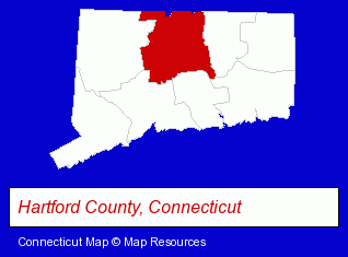
The Connecticut counties map at upper right shows Hartford County, highlighted in red. Use the menu below to display interactive maps of West Hartford, either in a frame on this page or in full-screen mode.
Use the menu below to display categorized West Hartford directories.
| West Hartford Products and Services Directory | ||
|---|---|---|
| Attorneys | Building Materials | Business Services |
| Home Improvement | Insurance | Metal Finishing |
| Metals | Physicians | Restaurants |
| Schools | Visual Arts | |
Selected West Hartford, Connecticut Listings
These randomly selected West Hartford listings provide some insight into the town's cultural environment and economic climate.- Industrial Equipment & Supplies Dealers
- Industrial Equipment & Supplies Wholesale & Manufacturers
- Motor Oils & Greases
- Home Improvement Stores
- Hardware Dealers
- Business Consultants & Advisors
- Management Consultants
- Business Management Services
- Outdoor Sports & Recreation
- Hunting
- Gun Accessories Manufacturers
- Guns Wholesale & Manufacturers
- Swimming Pool Dealers
- Water Sports
- Swimming Instruction
- Clothing & Accessories Retail
- Jewelers
- Jewelry Repair
- Watch Service & Repair
- Jewelry Brokers & Buyers
- Libraries
- Elementary & Secondary Education
- Public Schools
- High Schools
- Elementary & Secondary Education
- Charitable & Nonprofit Organizations
- Elementary Schools
- Private Schools
- Corporate Business Attorneys
- Arbitration & Mediation Services
- Arbitration & Mediation Services Attorneys
- Appeals Attorneys
- Printing & Publishing
- Bookbinding
- Industrial Equipment & Supplies Dealers
- Industrial Equipment & Supplies Wholesale & Manufacturers
- Industrial Equipment Rebuilding, Service & Repair
- Air Conditioning & Refrigeration Compressors
- Business Consultants & Advisors
- Management Consultants
- Business Management Services
- Business Consultants & Advisors
- Floors & Flooring Retail
- Die Cutting Equipment & Supplies
- Cutting Tools Wholesale & Manufacturers
- Furniture Stores
- Clothing & Accessories Retail
- Toy Stores
- Baby Accessories Rental
- Lawn & Garden Services
- Lawn Services
- Ornamental Shrub & Tree Services
- Tree Trimming Services
- Forestry Services
Nearby Connecticut Cities and Towns *
- Avon (1) - Avon, Connecticut information and maps.
- Bloomfield (1) - Bloomfield, Connecticut information and maps.
- Farmington (6) - Farmington, Connecticut demographics and maps.
- Hartford (16) - Hartford, Connecticut demographics and directory.
- New Britain (8) - New Britain, Connecticut demographics and maps.
- Newington (7) - Newington, Connecticut demographics and maps.
Large and Mid-size Cities in Nearby States
- Springfield, Massachusetts (18) - Springfield, MA demographics and directory.
- Westfield, Massachusetts (5) - Westfield, MA information and maps.
* Parenthesized numbers indicate economic activity levels.
Copyright © 2011-2026 RegionalDirectory.us. All rights reserved.