Wolcott, Connecticut Map and Directory
Regional Directory > States Menu > Connecticut
 According to the United States Census Bureau, Wolcott is a Town that is located in New Haven County, Connecticut at 41.59 degrees North and 72.97 degrees West.
The town's time zone is America/New York, and the town's primary telephone area code is 203.
The land area of Wolcott is about 20.43 square miles, whereas the water area of the town is about 0.67 square miles.
New Haven County's land area is about 605 square miles, so the town occupies about 3.4 percent of the county's total land area.
According to the United States Census Bureau, Wolcott is a Town that is located in New Haven County, Connecticut at 41.59 degrees North and 72.97 degrees West.
The town's time zone is America/New York, and the town's primary telephone area code is 203.
The land area of Wolcott is about 20.43 square miles, whereas the water area of the town is about 0.67 square miles.
New Haven County's land area is about 605 square miles, so the town occupies about 3.4 percent of the county's total land area.
The Census Bureau estimates that Wolcott had about 16,615 residents in 2019, which is approximately 813 people per square mile of land area.
According to recent American Community Survey data, the median household income in Wolcott was about $95,257 per year.
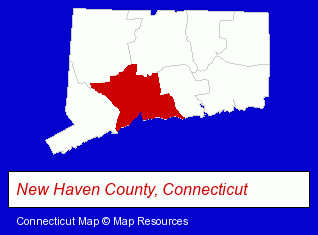
The Connecticut counties map at upper right shows New Haven County, highlighted in red. Use the menu below to display interactive maps of Wolcott, either in a frame on this page or in full-screen mode.
Use the menu below to display categorized Wolcott directories.
| Wolcott Products and Services Directory | |
|---|---|
| Metal Products Dealers | Metals |
Selected Wolcott, Connecticut Listings
These representative Wolcott listings provide some insight into the town's cultural environment and economic climate. Gagne & Madigan- Attorneys
- Personal Injury Attorneys
- Criminal Law Attorneys
- Trial Attorneys
- Metal Stamping
- Coffee & Tea Shops
- Candy & Confectionery Retail
- Vending Machines
- Food Equipment & Supplies
- Energy & Environment
- Recycling Services, Equipment & Supplies
- Waste Recycling Industrial
- Scrap Iron & Metals
Nearby Connecticut Cities and Towns *
- Bristol (7) - Bristol, Connecticut demographics and maps.
- Cheshire (6) - Cheshire, Connecticut demographics and maps.
- Plainville (3) - Plainville, Connecticut information and maps.
- Southington (3) - Southington, Connecticut information and maps.
- Thomaston (4) - Thomaston, Connecticut information and maps.
- Waterbury (12) - Waterbury, Connecticut demographics and directory.
- Watertown (4) - Watertown, Connecticut information and maps.
* Parenthesized numbers indicate economic activity levels.
Copyright © 2011-2026 RegionalDirectory.us. All rights reserved.