Thomaston, Connecticut Map and Directory
Regional Directory > States Menu > Connecticut
 According to the United States Census Bureau, Thomaston is a Town that is located in Litchfield County, Connecticut at 41.66 degrees North and 73.10 degrees West.
The town's time zone is America/New York, and the town's primary telephone area code is 959.
The land area of Thomaston is about 11.99 square miles, whereas the water area of the town is about 0.22 square miles.
Litchfield County's land area is about 921 square miles, so the town occupies about 1.3 percent of the county's total land area.
According to the United States Census Bureau, Thomaston is a Town that is located in Litchfield County, Connecticut at 41.66 degrees North and 73.10 degrees West.
The town's time zone is America/New York, and the town's primary telephone area code is 959.
The land area of Thomaston is about 11.99 square miles, whereas the water area of the town is about 0.22 square miles.
Litchfield County's land area is about 921 square miles, so the town occupies about 1.3 percent of the county's total land area.
The Census Bureau estimates that Thomaston had about 7,599 residents in 2019, which is approximately 634 people per square mile of land area.
According to recent American Community Survey data, the median household income in Thomaston was about $68,539 per year.
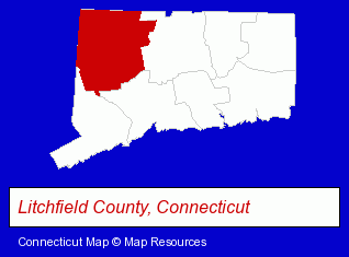
The Connecticut counties map at upper right shows Litchfield County, highlighted in red. Use the menu below to display interactive maps of Thomaston, either in a frame on this page or in full-screen mode.
Use the menu below to display categorized Thomaston directories.
| Thomaston Products and Services Directory | ||
|---|---|---|
| Building Materials | Home Improvement | Metal Products Dealers |
| Metals | ||
Selected Thomaston, Connecticut Listings
These randomly selected Thomaston listings provide some insight into the town's cultural environment and economic climate.- Metal Products
- Metal Products Wholesale & Manufacturers
- Industrial Equipment & Supplies Dealers
- Industrial Equipment Rebuilding, Service & Repair
- Machine Tools Rebuilding & Repair
- Used & Rebuilt Industrial Equipment Dealers
- Industrial Equipment & Supplies Dealers
- Industrial Equipment & Supplies Wholesale & Manufacturers
- Building & Home Construction
- Real Estate Inspection Services
- Home & Building Inspection
- Mold & Mildew Prevention, Inspection & Removal
- Carpet Cleaning Products Wholesale & Manufacturers
- Attorneys
- Corporate Business Attorneys
- Arbitration & Mediation Services
- Arbitration & Mediation Services Attorneys
- Appeals Attorneys
- Metal Products
- Metal Products Wholesale & Manufacturers
- Metal Products Dealers
- Industrial Equipment & Supplies Dealers
- Industrial Equipment & Supplies Wholesale & Manufacturers
- Electric & Electronic Equipment & Supplies
- Electric Motor Dealers
- Computers & Equipment Rental & Leasing
Nearby Connecticut Cities and Towns *
- Bristol (7) - Bristol, Connecticut demographics and maps.
- Litchfield (2) - Litchfield, Connecticut information and maps.
- Torrington (4) - Torrington, Connecticut information and maps.
- Waterbury (12) - Waterbury, Connecticut demographics and directory.
- Watertown (4) - Watertown, Connecticut information and maps.
- Wolcott (2) - Wolcott, Connecticut information and maps.
- Woodbury (4) - Woodbury, Connecticut information and maps.
* Parenthesized numbers indicate economic activity levels.
Copyright © 2011-2026 RegionalDirectory.us. All rights reserved.