Woodbury, Connecticut Map and Directory
Regional Directory > States Menu > Connecticut
 According to the United States Census Bureau, Woodbury is a Town that is located in Litchfield County, Connecticut at 41.56 degrees North and 73.21 degrees West.
The town's time zone is America/New York, and the town's primary telephone area code is 203.
The land area of Woodbury is about 36.40 square miles, whereas the water area of the town is about 0.24 square miles.
Litchfield County's land area is about 921 square miles, so the town occupies about 4.0 percent of the county's total land area.
According to the United States Census Bureau, Woodbury is a Town that is located in Litchfield County, Connecticut at 41.56 degrees North and 73.21 degrees West.
The town's time zone is America/New York, and the town's primary telephone area code is 203.
The land area of Woodbury is about 36.40 square miles, whereas the water area of the town is about 0.24 square miles.
Litchfield County's land area is about 921 square miles, so the town occupies about 4.0 percent of the county's total land area.
The Census Bureau estimates that Woodbury had about 9,562 residents in 2019, which is approximately 263 people per square mile of land area.
According to recent American Community Survey data, the median household income in Woodbury was about $81,362 per year.
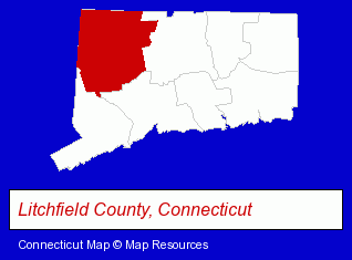
The Connecticut counties map at upper right shows Litchfield County, highlighted in red. Use the menu below to display interactive maps of Woodbury, either in a frame on this page or in full-screen mode.
Use the menu below to display categorized Woodbury directories.
| Woodbury Products and Services Directory | ||
|---|---|---|
| Antique Dealers | Antiques | Insurance |
| Restaurants | ||
Selected Woodbury, Connecticut Listings
These randomly selected Woodbury listings provide some insight into the town's cultural environment and economic climate.- Financial Services
- Trucking Companies
- Loan & Financing Services
- Heavy Duty Trucking
- Boarding Stables
- Equestrian Sports & Recreation
- Horseback Riding
- Horse Riding Schools & Instruction
- Horse Trainers
- Industrial Equipment & Supplies Dealers
- Medical Equipment & Supplies Retail
- Office Furniture & Equipment Dealers
- Physicians & Surgeons
- Alternative Medicine
- Alternative Medicine Practitioners
- Naturopathic Clinics
- Restaurants
- Restaurants
- Steak Restaurants
- Auto Service & Repair
- Swimming Pool Dealers
- Swimming Pools Installers
- Land Surveyors
- Surveyors
- Surveying Services
- Land Surveyors Commercial
- Health Insurance
- Health Care Plans
- Hospital & Medical Service Plans
Nearby Connecticut Cities and Towns *
- Danbury (17) - Danbury, Connecticut solutions directory and maps.
- Litchfield (2) - Litchfield, Connecticut information and maps.
- Newtown (3) - Newtown, Connecticut information and maps.
- Southbury (2) - Southbury, Connecticut information and maps.
- Thomaston (4) - Thomaston, Connecticut information and maps.
- Waterbury (12) - Waterbury, Connecticut demographics and directory.
- Watertown (4) - Watertown, Connecticut information and maps.
* Parenthesized numbers indicate economic activity levels.
Copyright © 2011-2026 RegionalDirectory.us. All rights reserved.