Ottumwa, Iowa Map and Directory
Regional Directory > States Menu > Iowa
 According to the United States Census Bureau, Ottumwa is a City that is located in Wapello County, Iowa at 41.02 degrees North and 92.41 degrees West.
The city's time zone is America/Chicago, and the city's primary telephone area code is 641.
The land area of Ottumwa is about 15.86 square miles, whereas the water area of the city is about 0.67 square miles.
Wapello County's land area is about 432 square miles, so the city occupies about 3.7 percent of the county's total land area.
According to the United States Census Bureau, Ottumwa is a City that is located in Wapello County, Iowa at 41.02 degrees North and 92.41 degrees West.
The city's time zone is America/Chicago, and the city's primary telephone area code is 641.
The land area of Ottumwa is about 15.86 square miles, whereas the water area of the city is about 0.67 square miles.
Wapello County's land area is about 432 square miles, so the city occupies about 3.7 percent of the county's total land area.
The Census Bureau estimates that Ottumwa had about 24,368 residents in 2019, which is approximately 1,536 people per square mile of land area.
According to recent American Community Survey data, the median household income in Ottumwa was about $41,722 per year.
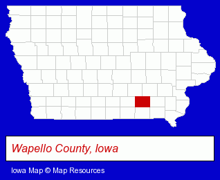
The Iowa counties map at upper right shows Wapello County, highlighted in red. Use the menu below to display interactive maps of Ottumwa, either in a frame on this page or in full-screen mode.
Use the menu below to display categorized Ottumwa directories.
| Ottumwa Directory Page: | Schools |
|---|
Selected Ottumwa, Iowa Listings
These Ottumwa listings provide some insight into the city's cultural environment and economic climate.- Hunting
- Gunsmiths
- Golf
- Golf Instruction
- Dentists
- Pediatrics Dentists
- Florists
- Collectibles Dealers
- Coin & Stamp Dealers & Supplies
- Physicians & Surgeons
- Orthopedics Physicians & Surgeons
- Industrial Equipment Rebuilding, Service & Repair
- Construction Machinery & Equipment Dealers
- Construction Machinery & Equipment Wholesale & Manufacturers
- Dentists
- Clinics & Medical Centers
- Clinics
Nearby Iowa Cities and Towns *
- Cedar Rapids (19) - Cedar Rapids, Iowa solutions directory and maps.
- Coralville (2) - Coralville, Iowa information and maps.
- Des Moines (28) - Des Moines, Iowa solutions directory and maps.
- Fairfield (1) - Fairfield, Iowa information and maps.
- Iowa City (8) - Iowa City, Iowa demographics and maps.
* Parenthesized numbers indicate economic activity levels.
Copyright © 2011-2026 RegionalDirectory.us. All rights reserved.