Cedar Rapids, Iowa Map and Directory
Regional Directory > States Menu > Iowa
 According to the United States Census Bureau, Cedar Rapids is a City that is located in Linn County, Iowa at 42.01 degrees North and 91.64 degrees West.
The city's time zone is America/Chicago, and the city's primary telephone area code is 319.
The land area of Cedar Rapids is about 70.79 square miles, whereas the water area of the city is about 1.27 square miles.
Linn County's land area is about 717 square miles, so the city occupies about 9.9 percent of the county's total land area.
According to the United States Census Bureau, Cedar Rapids is a City that is located in Linn County, Iowa at 42.01 degrees North and 91.64 degrees West.
The city's time zone is America/Chicago, and the city's primary telephone area code is 319.
The land area of Cedar Rapids is about 70.79 square miles, whereas the water area of the city is about 1.27 square miles.
Linn County's land area is about 717 square miles, so the city occupies about 9.9 percent of the county's total land area.
The Census Bureau estimates that Cedar Rapids had about 133,562 residents in 2019, which is approximately 1,887 people per square mile of land area.
According to recent American Community Survey data, the median household income in Cedar Rapids was about $58,511 per year.
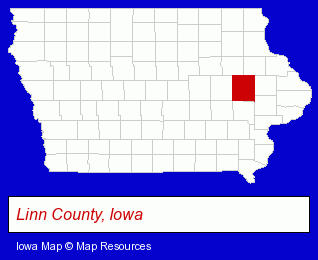
The Iowa counties map at upper right shows Linn County, highlighted in red. Use the menu below to display interactive maps of Cedar Rapids, either in a frame on this page or in full-screen mode.
Use the menu below to display categorized Cedar Rapids directories.
| Cedar Rapids Products and Services Directory | ||
|---|---|---|
| Attorneys | Auto Service | Business Services |
| Clinics | Dentists | Financial Services |
| Home Improvement | Metals | Moving and Storage |
| Physicians | Printing and Publishing | Restaurants |
| Schools | Truck Dealers | Veterinarians |
Selected Cedar Rapids, Iowa Listings
These randomly selected Cedar Rapids listings provide some insight into the city's cultural environment and economic climate.- Pet Care Services
- Pet Training
- Cosmetic & Reconstructive Surgeons
- Building & Home Construction
- Builders & Contractors
- Metal Building Contractors
- Animal Hospitals
- Animal Health
- Small Animal Veterinarians
- Utilities
- Electric Companies
- Electric Equipment & Supplies Dealers
- Electronic Equipment & Supplies Wholesale & Manufacturers
- Used Cars
- Used Trucks
- Accounting, Auditing & Bookkeeping Services
- Tax Return Preparation
- Payroll & Payroll Tax Preparation Services
- Industrial Equipment & Supplies Dealers
- Industrial Equipment & Supplies Wholesale & Manufacturers
- Industrial Equipment Rebuilding, Service & Repair
- Accounting, Auditing & Bookkeeping Services
- Colleges & Universities
- Caterers
- Food & Beverage Services
- Food & Beverage Consultants
- General Practice
- Gynecology & Obstetrics Physicians & Surgeons
- Metal Products
- Metal Products Wholesale & Manufacturers
- Manufacturing Production
- Marine Equipment & Supplies Retail
- Industrial Equipment & Supplies Dealers
- Industrial Equipment & Supplies Wholesale & Manufacturers
- Building Materials & Supplies Wholesale & Manufacturers
- Industrial Equipment Parts & Accessories Wholesale & Manufacturers
- Banquet Facilities
- Wedding Planners
- Rehabilitation Services
- Rehabilitation Centers
- Nursing & Convalescent Homes
Nearby Iowa Cities and Towns *
- Cedar Falls (7) - Cedar Falls, Iowa demographics and maps.
- Coralville (2) - Coralville, Iowa information and maps.
- Dubuque (10) - Dubuque, Iowa demographics and directory.
- Iowa City (8) - Iowa City, Iowa demographics and maps.
- Marion (1) - Marion, Iowa information and maps.
- Vinton (1) - Vinton, Iowa information and maps.
- Waterloo (6) - Waterloo, Iowa demographics and maps.
* Parenthesized numbers indicate economic activity levels.
Copyright © 2011-2026 RegionalDirectory.us. All rights reserved.