Coeur d Alene, Idaho Map and Directory
Regional Directory > States Menu > Idaho
 According to the United States Census Bureau, Coeur d Alene is a City that is located in Kootenai County, Idaho at 47.68 degrees North and 116.78 degrees West.
The city's time zone is America/Los Angeles, and the city's primary telephone area code is 208.
The land area of Coeur d Alene is about 15.59 square miles, whereas the water area of the city is about 0.51 square miles.
Kootenai County's land area is about 1,244 square miles, so the city occupies about 1.3 percent of the county's total land area.
According to the United States Census Bureau, Coeur d Alene is a City that is located in Kootenai County, Idaho at 47.68 degrees North and 116.78 degrees West.
The city's time zone is America/Los Angeles, and the city's primary telephone area code is 208.
The land area of Coeur d Alene is about 15.59 square miles, whereas the water area of the city is about 0.51 square miles.
Kootenai County's land area is about 1,244 square miles, so the city occupies about 1.3 percent of the county's total land area.
The Census Bureau estimates that Coeur d Alene had about 47,912 residents in 2014, which is approximately 3,073 people per square mile of land area.
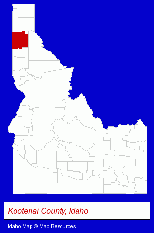
The Idaho counties map at upper right shows Kootenai County, highlighted in red. Use the menu below to display interactive maps of Coeur d Alene, either in a frame on this page or in full-screen mode.
Use the menu below to display categorized Coeur d Alene directories.
| Coeur d Alene Products and Services Directory | ||
|---|---|---|
| Advertising Agencies | Attorneys | Auto Service |
| Chiropractors | Clothing Stores | Dentists |
| Home Improvement | Insurance | Printing and Publishing |
| Photographers | Restaurants | Schools |
| Visual Arts | ||
Selected Coeur d Alene, Idaho Listings
These randomly selected Coeur d Alene listings provide some insight into the city's cultural environment and economic climate.- Bar & Grill Restaurants
- Mexican Restaurants
- Office Supplies Retail
- Stationery Retail
- Office Supplies Retail
- Gift Shops
- Stationery Retail
- Textiles Wholesale & Manufacturers
- Fabrics Wholesale & Manufacturers
- Optometrists
- Contact Lenses
- Portrait Photographers
- Banks
- Law Enforcement
- Health Insurance
- Insurance Agents & Brokers
- Life Insurance
- Hearing Aids & Assistive Devices Retail
- Hearing Aid & Assistive Device Service & Repair
- Audiologists
- Commercial Printing
- Newspaper Publishers
- Rehabilitation Services
- General Practice
- Orthopedics Physicians & Surgeons
- Electric Contractors
- Professional Engineers
- Electric Companies
- Electric Contractors Commercial & Industrial
- Small Electrical Appliances Repair & Parts
- Corporate Business Attorneys
- Estate Planning & Administration Attorneys
- Employment & Labor Law Attorneys
- Building & Home Construction
- Auto Service & Repair
- Sign Dealers
- Commercial & Graphic Artists
- Truck Service & Repair
- Consulting Engineers
- Testing Laboratories
- Geological Engineers
- Italian Restaurants
- Alternative Medicine
- Chiropractors
- Beauty Salons
- Beauty & Day Spas
- Manicures & Pedicures
- Spas & Saunas
Nearby Idaho Cities and Towns *
- Hayden (3) - Hayden, Idaho information and maps.
- Lewiston (7) - Lewiston, Idaho demographics and maps.
- Meridian (21) - Meridian, Idaho solutions directory and maps.
- Moscow (1) - Moscow, Idaho information and maps.
- Orofino (1) - Orofino, Idaho information and maps.
- Post Falls (4) - Post Falls, Idaho information and maps.
- Sandpoint (7) - Sandpoint, Idaho demographics and maps.
* Parenthesized numbers indicate economic activity levels.
Copyright © 2011-2026 RegionalDirectory.us. All rights reserved.