Post Falls, Idaho Map and Directory
Regional Directory > States Menu > Idaho
 According to the United States Census Bureau, Post Falls is a City that is located in Kootenai County, Idaho at 47.72 degrees North and 116.95 degrees West.
The city's time zone is America/Los Angeles, and the city's primary telephone area code is 208.
The land area of Post Falls is about 14.35 square miles, whereas the water area of the city is about 0.04 square miles.
Kootenai County's land area is about 1,244 square miles, so the city occupies about 1.2 percent of the county's total land area.
According to the United States Census Bureau, Post Falls is a City that is located in Kootenai County, Idaho at 47.72 degrees North and 116.95 degrees West.
The city's time zone is America/Los Angeles, and the city's primary telephone area code is 208.
The land area of Post Falls is about 14.35 square miles, whereas the water area of the city is about 0.04 square miles.
Kootenai County's land area is about 1,244 square miles, so the city occupies about 1.2 percent of the county's total land area.
The Census Bureau estimates that Post Falls had about 36,250 residents in 2019, which is approximately 2,526 people per square mile of land area.
According to recent American Community Survey data, the median household income in Post Falls was about $54,021 per year.
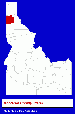
The Idaho counties map at upper right shows Kootenai County, highlighted in red. Use the menu below to display interactive maps of Post Falls, either in a frame on this page or in full-screen mode.
Use the menu below to display categorized Post Falls directories.
| Post Falls Products and Services Directory | ||
|---|---|---|
| Dentists | Insurance | Physicians |
| Restaurants | ||
Selected Post Falls, Idaho Listings
These randomly selected Post Falls listings provide some insight into the city's cultural environment and economic climate.- Landscape Contractors
- Florists
- Nurseries
- Greenhouses
- Engineers
- Architectural Engineers
- Auto Transport
- Trailer Renting & Leasing
- Utility Trailer Dealers
- Saddles & Harnesses
- Podiatry Physicians & Surgeons
- Auto Parts Retail
- Auto Dealers
- Used Cars
- Pediatrics Dentists
- Endodontics Dentists
- Industrial Equipment & Supplies Wholesale & Manufacturers
- Electric Equipment & Supplies Dealers
- Electronic Equipment & Supplies Wholesale & Manufacturers
- Manufacturing Production
- Rehabilitation Services
- Orthopedics Physicians & Surgeons
- Optometrists
- Contact Lenses
- Landscape Contractors
- Paving Contractors
- Landscape Equipment & Supplies Dealers
- Asphalt & Asphalt Products
- Metal Buildings Dealers
- Garage Builders
Nearby Idaho Cities and Towns *
- Coeur d Alene (18) - Coeur d Alene, Idaho solutions directory and maps.
- Hayden (3) - Hayden, Idaho information and maps.
- Lewiston (7) - Lewiston, Idaho demographics and maps.
- Meridian (21) - Meridian, Idaho solutions directory and maps.
- Moscow (1) - Moscow, Idaho information and maps.
- Orofino (1) - Orofino, Idaho information and maps.
- Sandpoint (7) - Sandpoint, Idaho demographics and maps.
Large and Mid-size Cities in Nearby States
- Spokane, Washington (59) - Spokane, WA products & services directory.
* Parenthesized numbers indicate economic activity levels.
Copyright © 2011-2026 RegionalDirectory.us. All rights reserved.