Idaho Falls, Idaho Map and Directory
Regional Directory > States Menu > Idaho
 According to the United States Census Bureau, Idaho Falls is a City that is located in Bonneville County, Idaho at 43.47 degrees North and 112.03 degrees West.
The city's time zone is America/Boise, and the city's primary telephone area code is 208.
The land area of Idaho Falls is about 22.58 square miles, whereas the water area of the city is about 0.45 square miles.
Bonneville County's land area is about 1,866 square miles, so the city occupies about 1.2 percent of the county's total land area.
According to the United States Census Bureau, Idaho Falls is a City that is located in Bonneville County, Idaho at 43.47 degrees North and 112.03 degrees West.
The city's time zone is America/Boise, and the city's primary telephone area code is 208.
The land area of Idaho Falls is about 22.58 square miles, whereas the water area of the city is about 0.45 square miles.
Bonneville County's land area is about 1,866 square miles, so the city occupies about 1.2 percent of the county's total land area.
The Census Bureau estimates that Idaho Falls had about 62,888 residents in 2019, which is approximately 2,785 people per square mile of land area.
According to recent American Community Survey data, the median household income in Idaho Falls was about $53,148 per year.
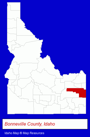
The Idaho counties map at upper right shows Bonneville County, highlighted in red. Use the menu below to display interactive maps of Idaho Falls, either in a frame on this page or in full-screen mode.
Use the menu below to display categorized Idaho Falls directories.
| Idaho Falls Products and Services Directory | ||
|---|---|---|
| Attorneys | Auto Service | Building Contractors |
| Building Materials | Chiropractors | Clothing Stores |
| Dentists | Home Improvement | Information Technology |
| Insurance | Moving and Storage | Physicians |
| Plumbing Contractors | Printing and Publishing | Schools |
| Visual Arts | ||
Selected Idaho Falls, Idaho Listings
These randomly selected Idaho Falls listings provide some insight into the city's cultural environment and economic climate.- Employment Agencies
- Payroll & Payroll Tax Preparation Services
- Industrial Equipment & Supplies Wholesale & Manufacturers
- Government Contractors
- Pumps, Parts & Supplies Dealers
- Marine Equipment & Supplies Retail
- Web Site Design
- Web Site Developers
- Internet Marketing Services
- Logos
- Advertising Agencies & Consultants
- Advertising & Design Agencies
- Commercial & Graphic Artists
- HVAC Equipment & Supplies Dealers
- Plumbing & Heating Supplies Retail
- Heating Equipment Parts & Supplies Dealers
- Heating Equipment Wholesale & Manufacturers
- Internet Services
- Internet Service Providers
- Telecommunications Services
- DSL Services
- Property & Casualty Insurance
- Life Insurance
- Restaurants
- Pizza Restaurants
- Bar & Grill Restaurants
- Fast Food Restaurants
- Sandwich Shops
- Industrial Equipment & Supplies Wholesale & Manufacturers
- Industrial Equipment Parts & Accessories Wholesale & Manufacturers
- Financing
- Podiatry Physicians & Surgeons
- Medical Equipment & Supplies Retail
- Hospital Supplies
- Dental Laboratories
- Engineers
- Government Contractors
- Architectural Engineers
- Signs Wholesale & Manufacturers
- Outdoor Advertising & Billboards
- Sign Installation & Hanging
Nearby Idaho Cities and Towns *
- Blackfoot (1) - Blackfoot, Idaho information and maps.
- Burley (1) - Burley, Idaho information and maps.
- Ketchum (4) - Ketchum, Idaho information and maps.
- Lava Hot Springs (1) - Lava Hot Springs, Idaho information and maps.
- Pocatello (10) - Pocatello, Idaho demographics and directory.
- Rexburg (4) - Rexburg, Idaho information and maps.
- Twin Falls (10) - Twin Falls, Idaho demographics and directory.
* Parenthesized numbers indicate economic activity levels.
Copyright © 2011-2026 RegionalDirectory.us. All rights reserved.