Aurora, Illinois Map and Directory
Regional Directory > States Menu > Illinois
 According to the United States Census Bureau, Aurora is a City that is located primarily in Kane County, Illinois at 41.76 degrees North and 88.29 degrees West.
The city's time zone is America/Chicago, and the city's primary telephone area code is 630.
The land area of Aurora is about 44.89 square miles, whereas the water area of the city is about 0.88 square miles.
According to the United States Census Bureau, Aurora is a City that is located primarily in Kane County, Illinois at 41.76 degrees North and 88.29 degrees West.
The city's time zone is America/Chicago, and the city's primary telephone area code is 630.
The land area of Aurora is about 44.89 square miles, whereas the water area of the city is about 0.88 square miles.
The Census Bureau estimates that Aurora had about 197,757 residents in 2019, which is approximately 4,405 people per square mile of land area.
According to recent American Community Survey data, the median household income in Aurora was about $71,749 per year.
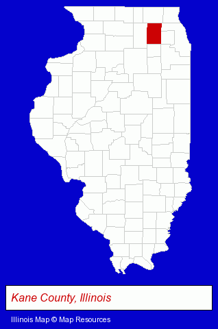
The Illinois counties map at upper right shows Kane County, highlighted in red. Use the menu below to display interactive maps of Aurora, either in a frame on this page or in full-screen mode.
Use the menu below to display categorized Aurora directories.
| Aurora Products and Services Directory | ||
|---|---|---|
| Accountants | Attorneys | Building Materials |
| Business Services | Chiropractors | Clinics |
| Dentists | Home Improvement | Information Technology |
| Insurance | Landscape Contractors | Metals |
| Physicians | Restaurants | Schools |
Selected Aurora, Illinois Listings
These randomly selected Aurora listings in 60506 provide a window into the city's cultural environment and economic climate. A Lindoo Building Maintenance- Office Building & Industrial Cleaning Services
- Janitorial Services
- Government Contractors
- Social Workers
- Industrial Equipment & Supplies Dealers
- Industrial Equipment Rebuilding, Service & Repair
- Machine Tools Rebuilding & Repair
- Cleaning Services
- Heating & Ventilating Contractors
- Carpet, Rug & Upholstery Cleaning
- Housecleaning
- Air Duct Cleaning
- Industrial Equipment & Supplies Wholesale & Manufacturers
- Industrial Equipment Parts & Accessories Wholesale & Manufacturers
- Textiles Wholesale & Manufacturers
- Fabrics Wholesale & Manufacturers
- Building & Home Construction
- Special Trades Contractors
- Electric Contractors
- Electric Contractors Residential
- Personal Injury Attorneys
- Employment & Labor Law Attorneys
- Furniture Stores
- Major Appliance Dealers
- Major Appliance Service & Repair
- Used Appliances
- Accounting, Auditing & Bookkeeping Services
- Tax Return Preparation
- Tax Return Preparation & Electronic Filing
- Plumbing Contractors
- Taxi Services
- Taxis
- Interior Decorators & Designers
- Painting Contractors
- Charitable & Nonprofit Organizations
- Retirement Communities & Homes
- Retirement Planning Consultants & Services
- Orthodontics Dentists
- Caterers
- Banquet Facilities
- Take Out
- Delicatessens
- Towing
- Elementary & Secondary Education
- Elementary Schools
- Colleges & Universities
- Educational Services
Nearby Illinois Cities and Towns *
- Batavia (5) - Batavia, Illinois demographics and maps.
- Geneva (12) - Geneva, Illinois demographics and directory.
- Naperville (43) - Naperville, Illinois products & services directory.
- Oswego (3) - Oswego, Illinois information and maps.
- Plainfield (14) - Plainfield, Illinois demographics and directory.
- Saint Charles (21) - Saint Charles, Illinois solutions directory and maps.
- West Chicago (3) - West Chicago, Illinois information and maps.
* Parenthesized numbers indicate economic activity levels.
Copyright © 2011-2026 RegionalDirectory.us. All rights reserved.