Oswego, Illinois Map and Directory
Regional Directory > States Menu > Illinois
 According to the United States Census Bureau, Oswego is a Village that is located in Kendall County, Illinois at 41.68 degrees North and 88.35 degrees West.
The village's time zone is America/Chicago, and the village's primary telephone area code is 630.
The land area of Oswego is about 15.53 square miles, whereas the water area of the village is about 0.15 square miles.
Kendall County's land area is about 320 square miles, so the village occupies about 4.9 percent of the county's total land area.
According to the United States Census Bureau, Oswego is a Village that is located in Kendall County, Illinois at 41.68 degrees North and 88.35 degrees West.
The village's time zone is America/Chicago, and the village's primary telephone area code is 630.
The land area of Oswego is about 15.53 square miles, whereas the water area of the village is about 0.15 square miles.
Kendall County's land area is about 320 square miles, so the village occupies about 4.9 percent of the county's total land area.
The Census Bureau estimates that Oswego had about 36,252 residents in 2019, which is approximately 2,334 people per square mile of land area.
According to recent American Community Survey data, the median household income in Oswego was about $102,110 per year.
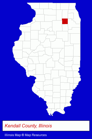
The Illinois counties map at upper right shows Kendall County, highlighted in red. Use the menu below to display interactive maps of Oswego, either in a frame on this page or in full-screen mode.
Use the menu below to display categorized Oswego directories.
| Oswego Products and Services Directory | ||
|---|---|---|
| Business Services | Dentists | Optometrists |
Selected Oswego, Illinois Listings
These representative Oswego listings provide some insight into the village's cultural environment and economic climate.- Physicians & Surgeons
- Pediatrics Physicians & Surgeons
- General Practice
- Auto Insurance
- Alternative Medicine
- Chiropractors
- Alternative Medicine Practitioners
- Veterinarians
- Animal Hospitals
- Exporters
- Baking Products
- Industrial Equipment & Supplies Wholesale & Manufacturers
- Industrial Equipment Parts & Accessories Wholesale & Manufacturers
- Plastic Molders
- Plastic Molds Manufacturers
- Paving Contractors
- Lumber Dealers
- Brick Paver Dealers
- Landscape Contractors
- Landscape Equipment & Supplies Dealers
- Mulch
- Alternative Medicine
- Chiropractors
- Bicycle Repair & Maintenance
- Bicycle Rental
- Physicians & Surgeons
- Optometrists
- Optical Goods Retail
- Eyewear
- Gymnastics Instruction
- Financial Services
- Investment Services
- Stock & Bond Brokers
- Landscape Contractors
- Landscape Designers & Consultants
- Contact Lenses
- Bathroom Planning & Remodeling
- Boat Service & Repair
- Bathtubs & Sinks Repair & Refinishing
- Ceramic Tile Installation & Repair
- Business Consultants & Advisors
- Management Consultants
- Business Management Services
Nearby Illinois Cities and Towns *
- Aurora (25) - Aurora, Illinois solutions directory and maps.
- Naperville (43) - Naperville, Illinois products & services directory.
- North Aurora (2) - North Aurora, Illinois information and maps.
- Plainfield (14) - Plainfield, Illinois demographics and directory.
- Sugar Grove (1) - Sugar Grove, Illinois information and maps.
- Yorkville (3) - Yorkville, Illinois information and maps.
* Parenthesized numbers indicate economic activity levels.
Copyright © 2011-2026 RegionalDirectory.us. All rights reserved.