East Peoria, Illinois Map and Directory
Regional Directory > States Menu > Illinois
 According to the United States Census Bureau, East Peoria is a City that is located in Tazewell County, Illinois at 40.67 degrees North and 89.58 degrees West.
The city's time zone is America/Chicago, and the city's primary telephone area code is 309.
The land area of East Peoria is about 20.23 square miles, whereas the water area of the city is about 2.11 square miles.
Tazewell County's land area is about 649 square miles, so the city occupies about 3.1 percent of the county's total land area.
According to the United States Census Bureau, East Peoria is a City that is located in Tazewell County, Illinois at 40.67 degrees North and 89.58 degrees West.
The city's time zone is America/Chicago, and the city's primary telephone area code is 309.
The land area of East Peoria is about 20.23 square miles, whereas the water area of the city is about 2.11 square miles.
Tazewell County's land area is about 649 square miles, so the city occupies about 3.1 percent of the county's total land area.
The Census Bureau estimates that East Peoria had about 22,546 residents in 2019, which is approximately 1,114 people per square mile of land area.
According to recent American Community Survey data, the median household income in East Peoria was about $58,984 per year.
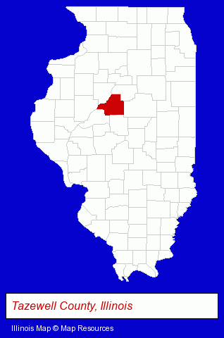
The Illinois counties map at upper right shows Tazewell County, highlighted in red. Use the menu below to display interactive maps of East Peoria, either in a frame on this page or in full-screen mode.
Use the menu below to display categorized East Peoria directories.
| East Peoria Products and Services Directory | |
|---|---|
| Dentists | Home Improvement |
Selected East Peoria, Illinois Listings
These representative East Peoria listings provide some insight into the city's cultural environment and economic climate.- Plumbing Contractors
- Plumbing & Heating Contractors
- Licensed Plumbing Contractors
- Building & Home Construction
- Builders & Contractors
- Special Trades Contractors
- Painting Contractors
- Painting Contractors Commercial & Industrial
- Electric Contractors Residential
- Professional Engineers
- Electrical Engineers
- Hotels
- Hotel & Motel Reservations
- Attorneys
- Accountants
- Certified Public Accountants
- Building Materials & Supplies Dealers
- Home Improvement Stores
- Hardware Dealers
- Lawn & Garden Outdoor Power Equipment
- Concrete Contractors
- Insurance
- Financing
- Pet Grooming
- Drapery & Curtain Fabrics Retail
- Paving Contractors
- Chiropractors
- Maxillofacial Physicians & Surgeons
- Antiques
- Auto Accessories Retail
- Auto Engines & Engine Parts
- Antique & Classic Auto Parts
- Attorneys
- Personal Injury Attorneys
- Criminal Law Attorneys
- Real Estate Attorneys
- Bankruptcy Attorneys
Nearby Illinois Cities and Towns *
- Bloomington (16) - Bloomington, Illinois demographics and directory.
- Morton (2) - Morton, Illinois information and maps.
- Normal (7) - Normal, Illinois demographics and maps.
- Pekin (4) - Pekin, Illinois information and maps.
- Peoria (41) - Peoria, Illinois products & services directory.
* Parenthesized numbers indicate economic activity levels.
Copyright © 2011-2026 RegionalDirectory.us. All rights reserved.