Angola, Indiana Map and Directory
Regional Directory > States Menu > Indiana
 According to the United States Census Bureau, Angola is a City that is located in Steuben County, Indiana at 41.63 degrees North and 85.00 degrees West.
The city's time zone is America/Indiana/Indianapolis, and the city's primary telephone area code is 260.
The land area of Angola is about 6.46 square miles, whereas the water area of the city is about 0.05 square miles.
Steuben County's land area is about 309 square miles, so the city occupies about 2.1 percent of the county's total land area.
According to the United States Census Bureau, Angola is a City that is located in Steuben County, Indiana at 41.63 degrees North and 85.00 degrees West.
The city's time zone is America/Indiana/Indianapolis, and the city's primary telephone area code is 260.
The land area of Angola is about 6.46 square miles, whereas the water area of the city is about 0.05 square miles.
Steuben County's land area is about 309 square miles, so the city occupies about 2.1 percent of the county's total land area.
The Census Bureau estimates that Angola had about 8,732 residents in 2019, which is approximately 1,352 people per square mile of land area.
According to recent American Community Survey data, the median household income in Angola was about $47,878 per year.
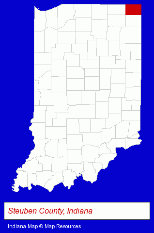
The Indiana counties map at upper right shows Steuben County, highlighted in red. Use the menu below to display interactive maps of Angola, either in a frame on this page or in full-screen mode.
Use the menu below to display categorized Angola directories.
| Angola Products and Services Directory | |
|---|---|
| Restaurants | Steak Restaurants |
Selected Angola, Indiana Listings
These representative Angola listings provide some insight into the city's cultural environment and economic climate.- Financial Services
- Accountants
- Public Accountants
- Accounting, Auditing & Bookkeeping Services
- Certified Public Accountants
- Retirement Planning Consultants & Services
- RV Insurance
- Metals
- Industrial Equipment Rebuilding, Service & Repair
- Welding Services
- Welding Contractors
- Visual Arts
- Photography
- Professional Photographers
- Portrait Photographers
- Banks
- Schools
- Public Schools
- Attorneys
- Truck Dealers
- Used Cars
- Used Trucks
- Auto Parts Wholesale & Manufacturers
- Truck Equipment, Parts & Accessories Retail
- Truck Parts & Equipment Wholesale & Manufacturers
Nearby Indiana Cities and Towns *
- Elkhart (15) - Elkhart, Indiana demographics and directory.
- Fort Wayne (31) - Fort Wayne, Indiana solutions directory and maps.
- Goshen (4) - Goshen, Indiana information and maps.
- Huntington (2) - Huntington, Indiana information and maps.
- Mishawaka (8) - Mishawaka, Indiana demographics and maps.
- Warsaw (5) - Warsaw, Indiana demographics and maps.
* Parenthesized numbers indicate economic activity levels.
Copyright © 2011-2026 RegionalDirectory.us. All rights reserved.