Carmel, Indiana Map and Directory
Regional Directory > States Menu > Indiana
 According to the United States Census Bureau, Carmel is a City that is located in Hamilton County, Indiana at 39.98 degrees North and 86.12 degrees West.
The city's time zone is America/Indiana/Indianapolis, and the city's primary telephone area code is 317.
The land area of Carmel is about 47.47 square miles, whereas the water area of the city is about 1.08 square miles.
Hamilton County's land area is about 394 square miles, so the city occupies about 12.0 percent of the county's total land area.
According to the United States Census Bureau, Carmel is a City that is located in Hamilton County, Indiana at 39.98 degrees North and 86.12 degrees West.
The city's time zone is America/Indiana/Indianapolis, and the city's primary telephone area code is 317.
The land area of Carmel is about 47.47 square miles, whereas the water area of the city is about 1.08 square miles.
Hamilton County's land area is about 394 square miles, so the city occupies about 12.0 percent of the county's total land area.
The Census Bureau estimates that Carmel had about 101,068 residents in 2019, which is approximately 2,129 people per square mile of land area.
According to recent American Community Survey data, the median household income in Carmel was about $112,765 per year.
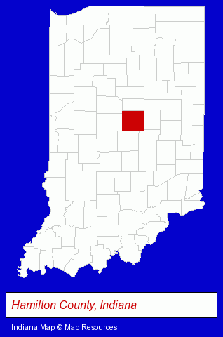
The Indiana counties map at upper right shows Hamilton County, highlighted in red. Use the menu below to display interactive maps of Carmel, either in a frame on this page or in full-screen mode.
Use the menu below to display categorized Carmel directories.
Selected Carmel, Indiana Listings
These randomly selected Carmel listings provide some insight into the city's cultural environment and economic climate.- Business Consultants & Advisors
- Advertising
- Advertising Agencies & Consultants
- Advertising & Design Agencies
- Health Insurance
- Health Care Plans
- Hospital & Medical Service Plans
- Orthodontics Dentists
- Truck Dealers
- Used Cars
- Used Trucks
- Public Accountants
- Audio Equipment & Supplies Dealers
- Stereo Equipment Dealers
- Audiovisual Equipment Service & Repair
- Stereo Equipment Parts & Supplies Dealers
- Title Insurance
- Real Estate Title Search & Abstract Services
- Charitable & Nonprofit Organizations
- Utilities
- Electric Companies
- Dermatology Physicians & Surgeons
- Clothing & Accessories Retail
- Jewelers
- Watch Service & Repair
- Clock Dealers & Repair
- Watches Retail
- Personal Financial Services
- Financial Counselors
- Manicures & Pedicures
- Beauty Supplies & Equipment Retail
- Artificial Nails & Eyelashes
- Business Consultants & Advisors
- Management Consultants
- Business Management Services
- Chemicals Wholesale & Manufacturers
- Churches
- Schools
- Preschools & Kindergartens
- United Methodist Churches
- Landscape Services
- Landscape Designers & Consultants
- Lawn & Garden Services
- Osteopathic Physicians & Surgeons
- Cosmetic & Reconstructive Surgeons
- Surgeons
Nearby Indiana Cities and Towns *
- Fishers (5) - Fishers, Indiana demographics and maps.
- Greenwood (6) - Greenwood, Indiana demographics and maps.
- Indianapolis (110) - Indianapolis, Indiana products & services directory.
- Noblesville (9) - Noblesville, Indiana demographics and directory.
- Westfield (1) - Westfield, Indiana information and maps.
- Zionsville (2) - Zionsville, Indiana information and maps.
* Parenthesized numbers indicate economic activity levels.
Copyright © 2011-2026 RegionalDirectory.us. All rights reserved.