Jasper, Indiana Map and Directory
Regional Directory > States Menu > Indiana
 According to the United States Census Bureau, Jasper is a City that is located in Dubois County, Indiana at 38.39 degrees North and 86.93 degrees West.
The city's time zone is America/Indiana/Vincennes, and the city's primary telephone area code is 812.
The land area of Jasper is about 13.26 square miles, whereas the water area of the city is about 0.09 square miles.
Dubois County's land area is about 427 square miles, so the city occupies about 3.1 percent of the county's total land area.
According to the United States Census Bureau, Jasper is a City that is located in Dubois County, Indiana at 38.39 degrees North and 86.93 degrees West.
The city's time zone is America/Indiana/Vincennes, and the city's primary telephone area code is 812.
The land area of Jasper is about 13.26 square miles, whereas the water area of the city is about 0.09 square miles.
Dubois County's land area is about 427 square miles, so the city occupies about 3.1 percent of the county's total land area.
The Census Bureau estimates that Jasper had about 15,724 residents in 2019, which is approximately 1,186 people per square mile of land area.
According to recent American Community Survey data, the median household income in Jasper was about $57,062 per year.
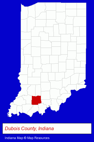
The Indiana counties map at upper right shows Dubois County, highlighted in red. Use the menu below to display interactive maps of Jasper, either in a frame on this page or in full-screen mode.
Use the menu below to display categorized Jasper directories.
| Jasper Directory Page: | Home Improvement |
|---|
Selected Jasper, Indiana Listings
These Jasper listings provide some insight into the city's cultural environment and economic climate.- Petroleum Products & Equipment
- Fuel Oils
- Petroleum Oils Retail
- Information Technology Services
- Internet Products & Services
- Internet Services
- Internet Service Providers
- Computer Networks
- Plastic & Plastic Products Wholesale & Manufacturers
- Plastic Foam Products
- Home Furnishings Stores
- Furniture Stores
- Office Furniture & Equipment Dealers
- Furniture Wholesale & Manufacturers
- Insurance
- Restaurants
- Banquet Facilities
- Food & Beverage Services
- Food & Beverage Delivery Services
- Clothing Stores
Nearby Indiana Cities and Towns *
- Bedford (3) - Bedford, Indiana information and maps.
- Bloomington (17) - Bloomington, Indiana solutions directory and maps.
- Evansville (26) - Evansville, Indiana solutions directory and maps.
- Nashville (1) - Nashville, Indiana information and maps.
- New Albany (7) - New Albany, Indiana demographics and maps.
- Newburgh (3) - Newburgh, Indiana information and maps.
- Vincennes (1) - Vincennes, Indiana information and maps.
Large and Mid-size Cities in Nearby States
- Owensboro, Kentucky (6) - Owensboro, KY information and maps.
* Parenthesized numbers indicate economic activity levels.
Copyright © 2011-2026 RegionalDirectory.us. All rights reserved.