Vincennes, Indiana Map and Directory
Regional Directory > States Menu > Indiana
 According to the United States Census Bureau, Vincennes is a City that is located in Knox County, Indiana at 38.68 degrees North and 87.53 degrees West.
The city's time zone is America/Indiana/Vincennes, and the city's primary telephone area code is 812.
The land area of Vincennes is about 7.41 square miles, whereas the water area of the city is about 0.07 square miles.
Knox County's land area is about 516 square miles, so the city occupies about 1.4 percent of the county's total land area.
According to the United States Census Bureau, Vincennes is a City that is located in Knox County, Indiana at 38.68 degrees North and 87.53 degrees West.
The city's time zone is America/Indiana/Vincennes, and the city's primary telephone area code is 812.
The land area of Vincennes is about 7.41 square miles, whereas the water area of the city is about 0.07 square miles.
Knox County's land area is about 516 square miles, so the city occupies about 1.4 percent of the county's total land area.
The Census Bureau estimates that Vincennes had about 16,862 residents in 2019, which is approximately 2,276 people per square mile of land area.
According to recent American Community Survey data, the median household income in Vincennes was about $38,412 per year.
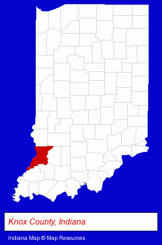
The Indiana counties map at upper right shows Knox County, highlighted in red. Use the menu below to display interactive maps of Vincennes, either in a frame on this page or in full-screen mode.
Use the menu below to display categorized Vincennes directories.
| Vincennes Directory Page: | Business Services |
|---|
Selected Vincennes, Indiana Listings
These Vincennes listings provide some insight into the city's cultural environment and economic climate. Baird Homes-Vincennes- Building & Home Construction
- Homes & Residential Real Estate
- Prefabricated & Modular Buildings
- Manufactured, Modular & Mobile Home Dealers
- Wireless Communications
- Cell Phones
- Cell Phone Services
- Cell Phone Equipment & Supplies
- Cell Phone Repair & Installation
- Grocery Stores & Supermarkets
- Fruits & Vegetables Retail
- Fruits & Vegetables Wholesale
- Business Consultants & Advisors
- Libraries
- Insurance
Nearby Indiana Cities and Towns *
- Bedford (3) - Bedford, Indiana information and maps.
- Bloomington (17) - Bloomington, Indiana solutions directory and maps.
- Evansville (26) - Evansville, Indiana solutions directory and maps.
- Jasper (1) - Jasper, Indiana information and maps.
- Newburgh (3) - Newburgh, Indiana information and maps.
- Terre Haute (8) - Terre Haute, Indiana demographics and maps.
* Parenthesized numbers indicate economic activity levels.
Copyright © 2011-2026 RegionalDirectory.us. All rights reserved.