Fort Scott, Kansas Map and Directory
Regional Directory > States Menu > Kansas
 According to the United States Census Bureau, Fort Scott is a City that is located in Bourbon County, Kansas at 37.84 degrees North and 94.71 degrees West.
The city's time zone is America/Chicago, and the city's primary telephone area code is 620.
The land area of Fort Scott is about 5.55 square miles, whereas the water area of the city is about 0.04 square miles.
Bourbon County's land area is about 635 square miles, so the city occupies about 0.9 percent of the county's total land area.
According to the United States Census Bureau, Fort Scott is a City that is located in Bourbon County, Kansas at 37.84 degrees North and 94.71 degrees West.
The city's time zone is America/Chicago, and the city's primary telephone area code is 620.
The land area of Fort Scott is about 5.55 square miles, whereas the water area of the city is about 0.04 square miles.
Bourbon County's land area is about 635 square miles, so the city occupies about 0.9 percent of the county's total land area.
The Census Bureau estimates that Fort Scott had about 7,697 residents in 2019, which is approximately 1,387 people per square mile of land area.
According to recent American Community Survey data, the median household income in Fort Scott was about $35,417 per year.
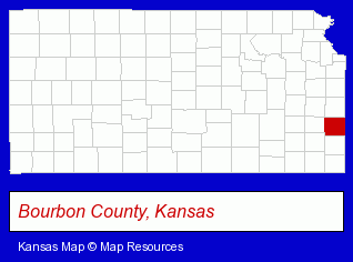
The Kansas counties map at upper right shows Bourbon County, highlighted in red. Use the menu below to display interactive maps of Fort Scott, either in a frame on this page or in full-screen mode.
Use the menu below to display categorized Fort Scott directories.
| Fort Scott Directory Page: | Attorneys |
|---|
Selected Fort Scott, Kansas Listings
These Fort Scott listings provide some insight into the city's cultural environment and economic climate.- Veterinarians
- Animal Hospitals
- Banks
- Insurance
- Metals
- Plastic & Plastic Products Wholesale & Manufacturers
- Metal Finishing
- Plastic Extrusions
- Libraries
- Public Libraries
- Funeral Services
- Funeral Homes & Directors
- Cremation Services
- Pre-Arranged Funeral Plans
- Printing & Publishing
- Printing Services
- Advertising
- Advertising & Promotional Product Dealers
- Catalogs & Brochures
- Physicians & Surgeons
- Optometrists
- Osteopathic Physicians & Surgeons
- Ophthalmology Physicians & Surgeons
- General Surgeons
- Arbitration & Mediation Services
- Arbitrators
- Financial Services
- Accountants
- Public Accountants
- Accounting, Auditing & Bookkeeping Services
- Home Improvement & Maintenance
- Building Materials & Supplies Dealers
- Home Improvement Stores
- Hardware Dealers
- Paint Stores
Nearby Kansas Cities and Towns *
- Gardner (2) - Gardner, Kansas information and maps.
- Leawood (19) - Leawood, Kansas solutions directory and maps.
- Lenexa (17) - Lenexa, Kansas solutions directory and maps.
- Olathe (28) - Olathe, Kansas solutions directory and maps.
- Overland Park (51) - Overland Park, Kansas products & services directory.
- Prairie Village (4) - Prairie Village, Kansas information and maps.
* Parenthesized numbers indicate economic activity levels.
Copyright © 2011-2026 RegionalDirectory.us. All rights reserved.