Leawood, Kansas Map and Directory
Regional Directory > States Menu > Kansas
 According to the United States Census Bureau, Leawood is a City that is located in Johnson County, Kansas at 38.97 degrees North and 94.62 degrees West.
The city's time zone is America/Chicago, and the city's primary telephone area code is 913.
The land area of Leawood is about 15.07 square miles, whereas the water area of the city is about 0.10 square miles.
Johnson County's land area is about 473 square miles, so the city occupies about 3.2 percent of the county's total land area.
According to the United States Census Bureau, Leawood is a City that is located in Johnson County, Kansas at 38.97 degrees North and 94.62 degrees West.
The city's time zone is America/Chicago, and the city's primary telephone area code is 913.
The land area of Leawood is about 15.07 square miles, whereas the water area of the city is about 0.10 square miles.
Johnson County's land area is about 473 square miles, so the city occupies about 3.2 percent of the county's total land area.
The Census Bureau estimates that Leawood had about 34,727 residents in 2019, which is approximately 2,304 people per square mile of land area.
According to recent American Community Survey data, the median household income in Leawood was about $157,515 per year.
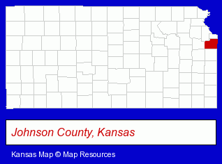
The Kansas counties map at upper right shows Johnson County, highlighted in red. Use the menu below to display interactive maps of Leawood, either in a frame on this page or in full-screen mode.
Use the menu below to display categorized Leawood directories.
| Leawood Products and Services Directory | ||
|---|---|---|
| Attorneys | Cosmetic Surgeons | Dentists |
| Financial Services | Health Clubs and Gyms | Insurance |
| Investment Services | Landscape Contractors | Physicians |
| Schools | ||
Selected Leawood, Kansas Listings
These randomly selected Leawood listings provide some insight into the city's cultural environment and economic climate.- Beauty Salons
- Hair Care & Treatment
- Beauty & Day Spas
- Hair Removal
- Veterinarians
- Animal Hospitals
- Pet Sitting & Day Care
- Drug Stores & Pharmacies
- Surgeons
- Maxillofacial Physicians & Surgeons
- Food Products Wholesale & Manufacturers
- Meats Retail
- Meats Wholesale
- Meats
- Machine Shops
- Machine Tool Dealers
- Home Furnishings Stores
- Interior Decorators & Designers
- Housewares Stores
- Counseling Services
- Counseling Centers
- Urology Physicians & Surgeons
- Advertising & Design Agencies
- Optometrists
- Optical Goods Retail
- Contact Lenses Retail
- Florists
- Floral & Balloon Arrangements
- General Practice
- Hair Removal
- Criminal Law Attorneys
- Trial Attorneys
- DUI and DWI Attorneys
- Property Management
- Shopping Centers & Malls
Nearby Kansas Cities and Towns *
- Kansas City (16) - Kansas City, Kansas demographics and directory.
- Lenexa (17) - Lenexa, Kansas solutions directory and maps.
- Olathe (28) - Olathe, Kansas solutions directory and maps.
- Overland Park (51) - Overland Park, Kansas products & services directory.
- Prairie Village (4) - Prairie Village, Kansas information and maps.
Large and Mid-size Cities in Nearby States
- Kansas City, Missouri (115) - Kansas City, MO products & services directory.
* Parenthesized numbers indicate economic activity levels.
Copyright © 2011-2026 RegionalDirectory.us. All rights reserved.