Kansas City, Kansas Map and Directory
Regional Directory > States Menu > Kansas
 According to the United States Census Bureau, Kansas City is a City that is located in Wyandotte County, Kansas at 39.11 degrees North and 94.63 degrees West.
The city's time zone is America/Chicago, and the city's primary telephone area code is 913.
The land area of Kansas City is about 124.81 square miles, whereas the water area of the city is about 3.56 square miles.
Wyandotte County's land area is about 152 square miles, so the city occupies about 82.1 percent of the county's total land area.
According to the United States Census Bureau, Kansas City is a City that is located in Wyandotte County, Kansas at 39.11 degrees North and 94.63 degrees West.
The city's time zone is America/Chicago, and the city's primary telephone area code is 913.
The land area of Kansas City is about 124.81 square miles, whereas the water area of the city is about 3.56 square miles.
Wyandotte County's land area is about 152 square miles, so the city occupies about 82.1 percent of the county's total land area.
The Census Bureau estimates that Kansas City had about 152,960 residents in 2019, which is approximately 1,226 people per square mile of land area.
According to recent American Community Survey data, the median household income in Kansas City was about $45,665 per year.
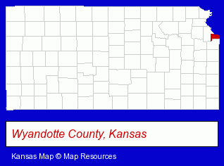
The Kansas counties map at upper right shows Wyandotte County, highlighted in red. Use the menu below to display interactive maps of Kansas City, either in a frame on this page or in full-screen mode.
Use the menu below to display categorized Kansas City directories.
Selected Kansas City, Kansas Listings
These randomly selected Kansas City listings provide some insight into the city's cultural environment and economic climate.- Surgical Instruments Wholesale & Manufacturers
- Hospital Supplies
- Home Health Care
- Transportation Services
- Commuter & Public Transportation
- Transportation Authorities, Brokers & Consultants
- Elderly & Disabled Transportation Services
- Furniture Stores
- Carpet, Rug & Upholstery Services
- Furniture Refinishing & Repair
- Carpet, Rug & Upholstery Storage & Repair
- Building & Home Construction
- Builders & Contractors
- Roofing Contractors
- Roofing
- Hospitals
- Visual Arts
- Photography
- Professional Photographers
- Photographers Commercial & Industrial
- Furniture Stores
- Restaurant Equipment & Services
- Restaurant Equipment & Supplies Wholesale & Manufacturers
- Medical Equipment & Supplies Retail
- Shopping Centers & Malls
- Churches
- General Practice
- Office Furniture & Equipment Dealers
- Office Furniture & Equipment Wholesale & Manufacturers
- Picture Frames Wholesale & Manufacturers
- Tree Services Commercial & Industrial
- Criminal Law Attorneys
- Family Law Attorneys
- Estate Planning & Administration Attorneys
- Corporate Business Attorneys
- Personal Injury Attorneys
- Criminal Law Attorneys
- Insurance Law Attorneys
- Art Galleries & Dealers
- Pictures & Prints Retail
- Picture Framing & Matting
- Truck Dealers
- Used Trucks
- Government Contractors
- Building Materials & Supplies Wholesale & Manufacturers
- Veterinarians
- Animal Hospitals
- Animal Health
- Architects
- Architectural Engineers
Nearby Kansas Cities and Towns *
- Leawood (19) - Leawood, Kansas solutions directory and maps.
- Lenexa (17) - Lenexa, Kansas solutions directory and maps.
- Olathe (28) - Olathe, Kansas solutions directory and maps.
- Overland Park (51) - Overland Park, Kansas products & services directory.
- Prairie Village (4) - Prairie Village, Kansas information and maps.
* Parenthesized numbers indicate economic activity levels.
Copyright © 2011-2026 RegionalDirectory.us. All rights reserved.