Lawrence, Kansas Map and Directory
Regional Directory > States Menu > Kansas
 According to the United States Census Bureau, Lawrence is a City that is located in Douglas County, Kansas at 38.97 degrees North and 95.24 degrees West.
The city's time zone is America/Chicago, and the city's primary telephone area code is 785.
The land area of Lawrence is about 34.32 square miles, whereas the water area of the city is about 0.78 square miles.
Douglas County's land area is about 456 square miles, so the city occupies about 7.5 percent of the county's total land area.
According to the United States Census Bureau, Lawrence is a City that is located in Douglas County, Kansas at 38.97 degrees North and 95.24 degrees West.
The city's time zone is America/Chicago, and the city's primary telephone area code is 785.
The land area of Lawrence is about 34.32 square miles, whereas the water area of the city is about 0.78 square miles.
Douglas County's land area is about 456 square miles, so the city occupies about 7.5 percent of the county's total land area.
The Census Bureau estimates that Lawrence had about 98,193 residents in 2019, which is approximately 2,861 people per square mile of land area.
According to recent American Community Survey data, the median household income in Lawrence was about $53,639 per year.
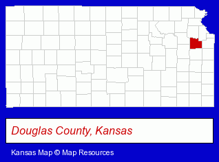
The Kansas counties map at upper right shows Douglas County, highlighted in red. Use the menu below to display interactive maps of Lawrence, either in a frame on this page or in full-screen mode.
Use the menu below to display categorized Lawrence directories.
Selected Lawrence, Kansas Listings
These randomly selected Lawrence listings provide some insight into the city's cultural environment and economic climate.- American Restaurants
- Party Equipment & Supplies Sales & Rental
- Janitorial Services
- Tool Rental & Leasing
- Janitorial Equipment & Supplies Wholesale & Manufacturers
- Portable Toilets
- Industrial Equipment & Supplies Dealers
- Industrial Equipment & Supplies Wholesale & Manufacturers
- Construction Machinery & Equipment Wholesale & Manufacturers
- Asphalt & Asphalt Products
- Paving Materials
- Family & General Practice Physicians & Surgeons
- Dermatology Physicians & Surgeons
- Gynecology & Obstetrics Physicians & Surgeons
- Cardiology Physicians & Surgeons
- Libraries
- Music Stores
- Used & Rare CDs, Tapes & Records
- Criminal Law Attorneys
- Family Law Attorneys
- Caterers
- Banquet Facilities
- Italian Restaurants
- Orthodontics Dentists
- Heating Contractors
- Air Conditioning Contractors
- Heating & Ventilating Contractors
- Heating Equipment Wholesale & Manufacturers
- Furnaces & Heating Equipment Wholesale & Manufacturers
- Musical Instruments Retail
- Musical Instrument Service & Repair
- Violins
Nearby Kansas Cities and Towns *
- Gardner (2) - Gardner, Kansas information and maps.
- Leavenworth (3) - Leavenworth, Kansas information and maps.
- Lenexa (17) - Lenexa, Kansas solutions directory and maps.
- Olathe (28) - Olathe, Kansas solutions directory and maps.
- Overland Park (51) - Overland Park, Kansas products & services directory.
- Topeka (38) - Topeka, Kansas products & services directory.
* Parenthesized numbers indicate economic activity levels.
Copyright © 2011-2026 RegionalDirectory.us. All rights reserved.