Brockton, Massachusetts Map and Directory
Regional Directory > States Menu > Massachusetts
 According to the United States Census Bureau, Brockton is a City that is located in Plymouth County, Massachusetts at 42.08 degrees North and 71.02 degrees West.
The city's time zone is America/New York, and the city's primary telephone area code is 774.
The land area of Brockton is about 21.33 square miles, whereas the water area of the city is about 0.20 square miles.
Plymouth County's land area is about 659 square miles, so the city occupies about 3.2 percent of the county's total land area.
According to the United States Census Bureau, Brockton is a City that is located in Plymouth County, Massachusetts at 42.08 degrees North and 71.02 degrees West.
The city's time zone is America/New York, and the city's primary telephone area code is 774.
The land area of Brockton is about 21.33 square miles, whereas the water area of the city is about 0.20 square miles.
Plymouth County's land area is about 659 square miles, so the city occupies about 3.2 percent of the county's total land area.
The Census Bureau estimates that Brockton had about 95,708 residents in 2019, which is approximately 4,487 people per square mile of land area.
According to recent American Community Survey data, the median household income in Brockton was about $58,469 per year.
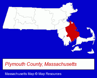
The Massachusetts counties map at upper right shows Plymouth County, highlighted in red. Use the menu below to display interactive maps of Brockton, either in a frame on this page or in full-screen mode.
Use the menu below to display categorized Brockton directories.
| Brockton Products and Services Directory | ||
|---|---|---|
| Attorneys | Auto Body Shops | Auto Service |
| Building Contractors | Construction Companies | Cremation Services |
| Dentists | Family Restaurants | Health Clubs and Gyms |
| Home Improvement | Insurance | Metal Products Dealers |
| Metals | Physicians | Restaurants |
Selected Brockton, Massachusetts Listings
These randomly selected Brockton listings provide some insight into the city's cultural environment and economic climate.- Health Information & Referral Services
- Health Care Consultants
- Business Services
- Engineers
- Consulting Engineers
- Antenna Towers
- Building & Home Construction
- Special Trades Contractors
- Electric Contractors
- Electric Contractors Residential
- Visual Arts
- Crafts & Craft Supplies Wholesale & Manufacturers
- Auto Parts Retail
- Auto Body Repair & Painting
- Funeral Services
- Funeral Homes & Directors
- Cremation Services
- Pre-Arranged Funeral Plans
- American Restaurants
- Take Out
- Family Restaurants
- Fast Food Restaurants
- Government Contractors
- Medical Equipment & Supplies Retail
- Heating & Ventilating Contractors
- Hospital Supplies
- Heating Equipment Wholesale & Manufacturers
- Printing & Publishing
- Office Supplies Retail
- Printing Equipment & Supplies Dealers
- Inks
- Educational Consultants
- Jewelers
- Jewelry Brokers & Buyers
- Child Care Centers
- Gymnastics Instruction
- Tires Retail
- Brake Service & Repair
- Auto Alignment, Frame & Axle Service & Repair
Nearby Massachusetts Cities and Towns *
- Canton (3) - Canton, Massachusetts information and maps.
- Hanover (3) - Hanover, Massachusetts information and maps.
- Hingham (5) - Hingham, Massachusetts demographics and maps.
- Quincy (17) - Quincy, Massachusetts solutions directory and maps.
- Stoughton (8) - Stoughton, Massachusetts demographics and maps.
- Taunton (6) - Taunton, Massachusetts demographics and maps.
* Parenthesized numbers indicate economic activity levels.
Copyright © 2011-2026 RegionalDirectory.us. All rights reserved.