Brookline, Massachusetts Map and Directory
Regional Directory > States Menu > Massachusetts
 According to the United States Census Bureau, Brookline is a Town that is located in Norfolk County, Massachusetts at 42.32 degrees North and 71.14 degrees West.
The town's time zone is America/New York, and the town's primary telephone area code is 857.
The land area of Brookline is about 6.75 square miles, whereas the water area of the town is about 0.06 square miles.
Norfolk County's land area is about 396 square miles, so the town occupies about 1.7 percent of the county's total land area.
According to the United States Census Bureau, Brookline is a Town that is located in Norfolk County, Massachusetts at 42.32 degrees North and 71.14 degrees West.
The town's time zone is America/New York, and the town's primary telephone area code is 857.
The land area of Brookline is about 6.75 square miles, whereas the water area of the town is about 0.06 square miles.
Norfolk County's land area is about 396 square miles, so the town occupies about 1.7 percent of the county's total land area.
The Census Bureau estimates that Brookline had about 59,180 residents in 2019, which is approximately 8,767 people per square mile of land area.
According to recent American Community Survey data, the median household income in Brookline was about $117,326 per year.
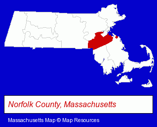
The Massachusetts counties map at upper right shows Norfolk County, highlighted in red. Use the menu below to display interactive maps of Brookline, either in a frame on this page or in full-screen mode.
Use the menu below to display categorized Brookline directories.
| Brookline Products and Services Directory | ||
|---|---|---|
| Attorneys | Business Services | Clinics |
| Dentists | Hotels | Museums |
| Music Instruction | Physicians | Restaurants |
| Schools | Visual Arts | |
Selected Brookline, Massachusetts Listings
These randomly selected Brookline listings provide some insight into the town's cultural environment and economic climate.- Electric Equipment & Supplies Dealers
- Electronic Equipment & Supplies Wholesale & Manufacturers
- Fabric Shops
- Pediatrics Dentists
- Printing & Publishing
- Publishers
- Magazine & Journal Publishers
- Motels
- Convention & Meeting Facilities & Services
- Educational Consultants
- Criminal Law Attorneys
- Family Law Attorneys
- Real Estate Attorneys
- Bankruptcy Attorneys
- Building & Home Construction
- Architects
- Architectural Services
- Home Improvement & Maintenance
- Building Materials & Supplies Dealers
- Advertising Agencies & Consultants
- Internet Products & Services
- Internet Services
- Internet Service Providers
Nearby Massachusetts Cities and Towns *
- Belmont (5) - Belmont, Massachusetts demographics and maps.
- Boston (96) - Boston, Massachusetts products & services directory.
- Cambridge (33) - Cambridge, Massachusetts products & services directory.
- Dedham (8) - Dedham, Massachusetts demographics and maps.
- Newton (11) - Newton, Massachusetts demographics and directory.
- Somerville (9) - Somerville, Massachusetts demographics and directory.
- Waltham (19) - Waltham, Massachusetts solutions directory and maps.
Large and Mid-size Cities in Nearby States
- Salem, New Hampshire (14) - Salem, NH demographics and directory.
* Parenthesized numbers indicate economic activity levels.
Copyright © 2011-2026 RegionalDirectory.us. All rights reserved.