Lowell, Massachusetts Map and Directory
Regional Directory > States Menu > Massachusetts
 According to the United States Census Bureau, Lowell is a City that is located in Middlesex County, Massachusetts at 42.63 degrees North and 71.32 degrees West.
The city's time zone is America/New York, and the city's primary telephone area code is 351.
The land area of Lowell is about 13.58 square miles, whereas the water area of the city is about 0.94 square miles.
Middlesex County's land area is about 818 square miles, so the city occupies about 1.7 percent of the county's total land area.
According to the United States Census Bureau, Lowell is a City that is located in Middlesex County, Massachusetts at 42.63 degrees North and 71.32 degrees West.
The city's time zone is America/New York, and the city's primary telephone area code is 351.
The land area of Lowell is about 13.58 square miles, whereas the water area of the city is about 0.94 square miles.
Middlesex County's land area is about 818 square miles, so the city occupies about 1.7 percent of the county's total land area.
The Census Bureau estimates that Lowell had about 110,997 residents in 2019, which is approximately 8,174 people per square mile of land area.
According to recent American Community Survey data, the median household income in Lowell was about $56,878 per year.
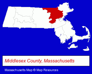
The Massachusetts counties map at upper right shows Middlesex County, highlighted in red. Use the menu below to display interactive maps of Lowell, either in a frame on this page or in full-screen mode.
Use the menu below to display categorized Lowell directories.
| Lowell Products and Services Directory | ||
|---|---|---|
| Attorneys | Auto Dealers | Auto Service |
| Building Contractors | Dentists | Fabric Shops |
| Home Improvement | Insurance | Museums |
| Physicians | Restaurants | Schools |
Selected Lowell, Massachusetts Listings
These randomly selected Lowell listings provide some insight into the city's cultural environment and economic climate.- Auto Body Repair & Painting
- Collision Services
- Plumbing Contractors
- Sewer & Drain Cleaning Contractors
- Auto Parts Retail
- Auto Accessories Retail
- Art Galleries & Dealers
- Sheet Metal Wholesale & Manufacturers
- Industrial Equipment Rebuilding, Service & Repair
- Auto Engine Service & Repair
- Brake Service & Repair
- Auto Electrical System Service & Repair
- General Practice
- Music Instruction
- Music
- Instrumental Music Instruction
- Guitars
- Guitar Instruction
- Optometrists
- Optical Goods Retail
- Electronic Equipment & Supplies Retail
- Electronic Components Retail
- Beverages Retail
- Taverns
- Cafes
Nearby Massachusetts Cities and Towns *
- Andover (8) - Andover, Massachusetts demographics and maps.
- Billerica (5) - Billerica, Massachusetts demographics and maps.
- Chelmsford (9) - Chelmsford, Massachusetts demographics and directory.
- Lawrence (4) - Lawrence, Massachusetts information and maps.
- Tewksbury (5) - Tewksbury, Massachusetts demographics and maps.
- Westford (3) - Westford, Massachusetts information and maps.
- Wilmington (3) - Wilmington, Massachusetts information and maps.
Large and Mid-size Cities in Nearby States
- Salem, New Hampshire (14) - Salem, NH demographics and directory.
* Parenthesized numbers indicate economic activity levels.
Copyright © 2011-2026 RegionalDirectory.us. All rights reserved.