Bel Air, Maryland Map and Directory
Regional Directory > States Menu > Maryland
 According to the United States Census Bureau, Bel Air is a Town that is located in Harford County, Maryland at 39.54 degrees North and 76.35 degrees West.
The town's time zone is America/New York, and the town's primary telephone area code is 410.
The land area of Bel Air is about 3.04 square miles, whereas the water area of the town is about 0.01 square miles.
Harford County's land area is about 437 square miles, so the town occupies about 0.7 percent of the county's total land area.
According to the United States Census Bureau, Bel Air is a Town that is located in Harford County, Maryland at 39.54 degrees North and 76.35 degrees West.
The town's time zone is America/New York, and the town's primary telephone area code is 410.
The land area of Bel Air is about 3.04 square miles, whereas the water area of the town is about 0.01 square miles.
Harford County's land area is about 437 square miles, so the town occupies about 0.7 percent of the county's total land area.
The Census Bureau estimates that Bel Air had about 10,119 residents in 2019, which is approximately 3,329 people per square mile of land area.
According to recent American Community Survey data, the median household income in Bel Air was about $71,122 per year.
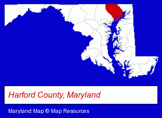
The Maryland counties map at upper right shows Harford County, highlighted in red. Use the menu below to display interactive maps of Bel Air, either in a frame on this page or in full-screen mode.
Use the menu below to display categorized Bel Air directories.
| Bel Air Products and Services Directory | ||
|---|---|---|
| Accountants | Attorneys | Business Services |
| Dentists | Home Improvement | Insurance |
| Physicians | Restaurants | Schools |
Selected Bel Air, Maryland Listings
These randomly selected Bel Air listings provide some insight into the town's cultural environment and economic climate.- Business Consultants & Advisors
- Management Consultants
- Business Management Services
- Computer Consultants
- Computer Systems Consultants & Designers
- General Practice
- Gynecology & Obstetrics Physicians & Surgeons
- Government Offices
- Police Departments
- Law Enforcement
- Public Accountants
- Certified Public Accountants
- Accounting, Auditing & Bookkeeping Services
- Tax Return Preparation
- Payroll & Payroll Tax Preparation Services
- Funeral Services
- Funeral Homes & Directors
- Cremation Services
- Maxillofacial Physicians & Surgeons
- Clothing Stores
Nearby Maryland Cities and Towns *
- Baltimore (45) - Baltimore, Maryland products & services directory.
- Bethesda (15) - Bethesda, Maryland demographics and directory.
- Dundalk (3) - Dundalk, Maryland information and maps.
- Frederick (21) - Frederick, Maryland solutions directory and maps.
- Gaithersburg (18) - Gaithersburg, Maryland solutions directory and maps.
- Hagerstown (13) - Hagerstown, Maryland demographics and directory.
- Oakland (1) - Oakland, Maryland information and maps.
- Owings Mills (7) - Owings Mills, Maryland demographics and maps.
- Parkville (2) - Parkville, Maryland information and maps.
- Rockville (23) - Rockville, Maryland solutions directory and maps.
- Rosedale (2) - Rosedale, Maryland information and maps.
- Towson (8) - Towson, Maryland demographics and maps.
* Parenthesized numbers indicate economic activity levels.
Copyright © 2011-2026 RegionalDirectory.us. All rights reserved.