Glen Burnie, Maryland Map and Directory
Regional Directory > States Menu > Maryland
 According to the United States Census Bureau, Glen Burnie is a Census-designated Place that is located in Anne Arundel County, Maryland at 39.16 degrees North and 76.62 degrees West.
The place's time zone is America/New York, and the place's primary telephone area code is 410.
The land area of Glen Burnie is about 17.32 square miles, whereas the water area of the place is about 0.71 square miles.
Anne Arundel County's land area is about 415 square miles, so the place occupies about 4.2 percent of the county's total land area.
According to the United States Census Bureau, Glen Burnie is a Census-designated Place that is located in Anne Arundel County, Maryland at 39.16 degrees North and 76.62 degrees West.
The place's time zone is America/New York, and the place's primary telephone area code is 410.
The land area of Glen Burnie is about 17.32 square miles, whereas the water area of the place is about 0.71 square miles.
Anne Arundel County's land area is about 415 square miles, so the place occupies about 4.2 percent of the county's total land area.
The Census Bureau estimates that Glen Burnie had about 69,872 residents in 2019, which is approximately 4,034 people per square mile of land area.
According to recent American Community Survey data, the median household income in Glen Burnie was about $70,769 per year.
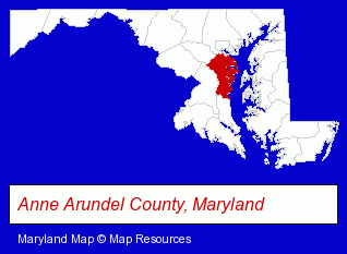
The Maryland counties map at upper right shows Anne Arundel County, highlighted in red. Use the menu below to display interactive maps of Glen Burnie, either in a frame on this page or in full-screen mode.
Use the menu below to display categorized Glen Burnie directories.
| Glen Burnie Products and Services Directory | ||
|---|---|---|
| Attorneys | Auto Service | Home Improvement |
| Metals | Restaurants | |
Selected Glen Burnie, Maryland Listings
These randomly selected Glen Burnie listings provide some insight into the place's cultural environment and economic climate.- Printing & Publishing
- Office Supplies Retail
- Bookbinding
- Commercial Bookbinders
- Cultural Attractions, Events & Facilities
- Tourist Information & Attractions
- Museums
- Banks
- Pest Control Services
- Pest Control Equipment & Supplies Retail
- Termite Control
- Pesticides
- Internal Medicine Physicians & Surgeons
- Steak Restaurants
- Bar & Grill Restaurants
- Take Out
- Auto Customizing, Conversion & Restoration
- Auto Cleaning & Detailing
- Auto Washing & Polishing
- Restaurant Equipment & Services
- Restaurant Equipment & Supplies Retail
- Restaurant Equipment & Supplies Wholesale & Manufacturers
- Insurance
- Charitable & Nonprofit Organizations
- Business & Professional Associations & Organizations
- Community & Civic Organizations
- Marine Professionals & Services
- Docks
- Boat Service & Repair
Nearby Maryland Cities and Towns *
- Annapolis (29) - Annapolis, Maryland solutions directory and maps.
- Baltimore (45) - Baltimore, Maryland products & services directory.
- Catonsville (3) - Catonsville, Maryland information and maps.
- Columbia (16) - Columbia, Maryland demographics and directory.
- Dundalk (3) - Dundalk, Maryland information and maps.
- Elkridge (2) - Elkridge, Maryland information and maps.
- Rosedale (2) - Rosedale, Maryland information and maps.
* Parenthesized numbers indicate economic activity levels.
Copyright © 2011-2026 RegionalDirectory.us. All rights reserved.