Caledonia, Michigan Map and Directory
Regional Directory > States Menu > Michigan
 According to the United States Census Bureau, Caledonia is a Village that is located in Kent County, Michigan at 42.79 degrees North and 85.52 degrees West.
The village's time zone is America/Detroit, and the village's primary telephone area code is 616.
The land area of Caledonia is about 1.33 square miles, whereas the water area of the village is about 0.08 square miles.
Kent County's land area is about 847 square miles, so the village occupies about 0.2 percent of the county's total land area.
According to the United States Census Bureau, Caledonia is a Village that is located in Kent County, Michigan at 42.79 degrees North and 85.52 degrees West.
The village's time zone is America/Detroit, and the village's primary telephone area code is 616.
The land area of Caledonia is about 1.33 square miles, whereas the water area of the village is about 0.08 square miles.
Kent County's land area is about 847 square miles, so the village occupies about 0.2 percent of the county's total land area.
The Census Bureau estimates that Caledonia had about 1,572 residents in 2014, which is approximately 1,182 people per square mile of land area.
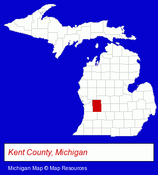
The Michigan counties map at upper right shows Kent County, highlighted in red. Use the menu below to display interactive maps of Caledonia, either in a frame on this page or in full-screen mode.
Use the menu below to display categorized Caledonia directories.
| Caledonia Directory Page: | Home Improvement |
|---|
Selected Caledonia, Michigan Listings
These Caledonia listings provide some insight into the village's cultural environment and economic climate.- Clothing & Accessories Retail
- Auto Service & Repair
- Auto Body Repair & Painting
- Auto Customizing, Conversion & Restoration
- Custom Auto Painting
- Building & Home Construction
- Builders & Contractors
- Metal Buildings Dealers
- Educational Consultants
- Building Materials & Supplies Dealers
- Door & Window Dealers
- Garage Doors & Openers
- Door & Door Frame Dealers
- Business Services
- Business Consultants & Advisors
- Advertising
- Advertising Agencies & Consultants
- Advertising & Design Agencies
- Clothing Stores
- Clothing & Accessories Retail
- Clothing & Accessories Consignment & Resale
- Used Clothing Retail
- Machine Tools Rebuilding & Repair
Nearby Michigan Cities and Towns *
- Ada (1) - Ada, Michigan information and maps.
- Grand Rapids (81) - Grand Rapids, Michigan products & services directory.
- Grandville (4) - Grandville, Michigan information and maps.
- Hastings (3) - Hastings, Michigan information and maps.
- Jenison (3) - Jenison, Michigan information and maps.
- Middleville (1) - Middleville, Michigan information and maps.
- Wyoming (5) - Wyoming, Michigan demographics and maps.
* Parenthesized numbers indicate economic activity levels.
Copyright © 2011-2026 RegionalDirectory.us. All rights reserved.