Grand Rapids, Michigan Map and Directory
Regional Directory > States Menu > Michigan
 According to the United States Census Bureau, Grand Rapids is a City that is located in Kent County, Michigan at 42.96 degrees North and 85.67 degrees West.
The city's time zone is America/Detroit, and the city's primary telephone area code is 616.
The land area of Grand Rapids is about 44.41 square miles, whereas the water area of the city is about 0.87 square miles.
Kent County's land area is about 847 square miles, so the city occupies about 5.2 percent of the county's total land area.
According to the United States Census Bureau, Grand Rapids is a City that is located in Kent County, Michigan at 42.96 degrees North and 85.67 degrees West.
The city's time zone is America/Detroit, and the city's primary telephone area code is 616.
The land area of Grand Rapids is about 44.41 square miles, whereas the water area of the city is about 0.87 square miles.
Kent County's land area is about 847 square miles, so the city occupies about 5.2 percent of the county's total land area.
The Census Bureau estimates that Grand Rapids had about 201,013 residents in 2019, which is approximately 4,526 people per square mile of land area.
According to recent American Community Survey data, the median household income in Grand Rapids was about $50,103 per year. This Grand Rapids Real Estate directory lists real estate solution providers in Grand Rapids, Michigan.
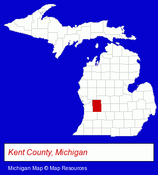
The Michigan counties map at upper right shows Kent County, highlighted in red. Use the menu below to display interactive maps of Grand Rapids, either in a frame on this page or in full-screen mode.
Use the menu below to display categorized Grand Rapids directories.
Selected Grand Rapids, Michigan Listings
These randomly selected Grand Rapids listings provide some insight into the city's cultural environment and economic climate.- Alternative Medicine
- Chiropractors
- Metal Stamping
- Metal Polishing, Buffing & Plating
- Public Accountants
- Certified Public Accountants
- Auto Parts Retail
- Construction Machinery & Equipment Dealers
- Hoisting & Rigging Equipment Dealers
- Race Car Parts, Equipment & Supplies Retail
- Outdoor Sports & Recreation
- Bicycle Dealers
- Bicycle Parts & Supplies Dealers
- Bicycle Racks & Security Systems
- Industrial Equipment & Supplies Dealers
- Engineers
- Engineering Services
- Machine Tool Dealers
- Mechanical Engineers
- Computer Software
- Computer & Equipment Dealers
- Computer & Software Stores
- Industrial Equipment & Supplies Dealers
- Industrial Equipment & Supplies Wholesale & Manufacturers
- Motor Oils & Greases
- Lubricating Oils Retail
- Furniture Stores
- Furniture Wholesale & Manufacturers
- Personal Loans
- Personal Financial Services
- Industrial Equipment Rental & Leasing
- Sports & Recreation Facilities
- Bowling Alleys
- Industrial Equipment & Supplies Wholesale & Manufacturers
- Industrial Equipment Parts & Accessories Wholesale & Manufacturers
- Welding Equipment & Supplies Retail
- Auto Customizing, Conversion & Restoration
- Custom Auto Painting
- Electric & Electronic Equipment & Supplies
- Electric Equipment & Supplies Dealers
- Electric Wire & Cable
- Building & Home Construction
- Special Trades Contractors
- Electric Contractors
- Electric Contractors Residential
Nearby Michigan Cities and Towns *
- Ada (1) - Ada, Michigan information and maps.
- Comstock Park (1) - Comstock Park, Michigan information and maps.
- Grandville (4) - Grandville, Michigan information and maps.
- Jenison (3) - Jenison, Michigan information and maps.
- Rockford (2) - Rockford, Michigan information and maps.
- Wyoming (5) - Wyoming, Michigan demographics and maps.
* Parenthesized numbers indicate economic activity levels.
Copyright © 2011-2026 RegionalDirectory.us. All rights reserved.