Gaylord, Michigan Map and Directory
Regional Directory > States Menu > Michigan
 According to the United States Census Bureau, Gaylord is a City that is located in Otsego County, Michigan at 45.03 degrees North and 84.67 degrees West.
The city's time zone is America/Detroit, and the city's primary telephone area code is 989.
The land area of Gaylord is about 4.86 square miles, whereas the water area of the city is about 0.02 square miles.
Otsego County's land area is about 515 square miles, so the city occupies about 0.9 percent of the county's total land area.
According to the United States Census Bureau, Gaylord is a City that is located in Otsego County, Michigan at 45.03 degrees North and 84.67 degrees West.
The city's time zone is America/Detroit, and the city's primary telephone area code is 989.
The land area of Gaylord is about 4.86 square miles, whereas the water area of the city is about 0.02 square miles.
Otsego County's land area is about 515 square miles, so the city occupies about 0.9 percent of the county's total land area.
The Census Bureau estimates that Gaylord had about 3,648 residents in 2014, which is approximately 751 people per square mile of land area.
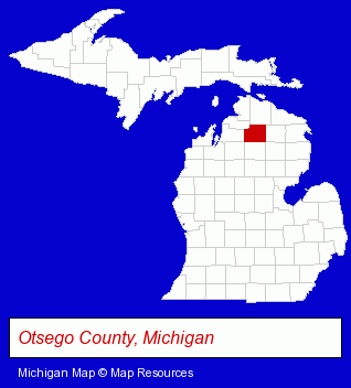
The Michigan counties map at upper right shows Otsego County, highlighted in red. Use the menu below to display interactive maps of Gaylord, either in a frame on this page or in full-screen mode.
Use the menu below to display categorized Gaylord directories.
| Gaylord Products and Services Directory | ||
|---|---|---|
| Financial Services | Restaurants | Schools |
Selected Gaylord, Michigan Listings
These representative Gaylord listings provide some insight into the city's cultural environment and economic climate.- Lawn & Garden Equipment & Supplies Retail
- Nurseries
- Garden Centers
- Accountants
- Public Accountants
- Accounting, Auditing & Bookkeeping Services
- Dentists
- Auto Dealers
- Truck Dealers
- Florists
- Elementary & Secondary Education
- Elementary Schools
- Churches
- Schools
- Colleges & Universities
- Engineers
- Civil Engineers
- Structural Engineers
- Home Improvement & Maintenance
- Building & Home Construction
- Heating Contractors
- Take Out
- Mexican Restaurants
- Food & Beverage Services
- Food & Beverage Delivery Services
- Attorneys
- Steak Restaurants
- Gift Shops
- Libraries
- Insurance
- Investment Services
- Insurance Agents & Brokers
- Investment Advisory Services
- Answering Services
Nearby Michigan Cities and Towns *
- Charlevoix (2) - Charlevoix, Michigan information and maps.
- Harbor Springs (2) - Harbor Springs, Michigan information and maps.
- Indian River (2) - Indian River, Michigan information and maps.
- Mackinac Island (1) - Mackinac Island, Michigan information and maps.
- Mackinaw City (2) - Mackinaw City, Michigan information and maps.
- Petoskey (7) - Petoskey, Michigan demographics and maps.
- Traverse City (30) - Traverse City, Michigan solutions directory and maps.
* Parenthesized numbers indicate economic activity levels.
Copyright © 2011-2026 RegionalDirectory.us. All rights reserved.