Petoskey, Michigan Map and Directory
Regional Directory > States Menu > Michigan
 According to the United States Census Bureau, Petoskey is a City that is located in Emmet County, Michigan at 45.37 degrees North and 84.96 degrees West.
The city's time zone is America/Detroit, and the city's primary telephone area code is 231.
The land area of Petoskey is about 5.11 square miles, whereas the water area of the city is about 0.20 square miles.
Emmet County's land area is about 467 square miles, so the city occupies about 1.1 percent of the county's total land area.
According to the United States Census Bureau, Petoskey is a City that is located in Emmet County, Michigan at 45.37 degrees North and 84.96 degrees West.
The city's time zone is America/Detroit, and the city's primary telephone area code is 231.
The land area of Petoskey is about 5.11 square miles, whereas the water area of the city is about 0.20 square miles.
Emmet County's land area is about 467 square miles, so the city occupies about 1.1 percent of the county's total land area.
The Census Bureau estimates that Petoskey had about 5,756 residents in 2019, which is approximately 1,126 people per square mile of land area.
According to recent American Community Survey data, the median household income in Petoskey was about $45,107 per year.
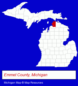
The Michigan counties map at upper right shows Emmet County, highlighted in red. Use the menu below to display interactive maps of Petoskey, either in a frame on this page or in full-screen mode.
Use the menu below to display categorized Petoskey directories.
| Petoskey Products and Services Directory | ||
|---|---|---|
| Attorneys | Building Materials | Clinics |
| Clothing Stores | Home Improvement | Hotels |
| Printing and Publishing | ||
Selected Petoskey, Michigan Listings
These randomly selected Petoskey listings provide some insight into the city's cultural environment and economic climate.- Gift Shops
- Bakeries
- Auto Parts Wholesale & Manufacturers
- Electronic Equipment & Supplies Wholesale & Manufacturers
- Lodging
- Hotels
- Motels
- Dentists
- Endodontics Dentists
- Lodging
- Bed & Breakfasts
- Bed & Breakfast Reservations
- Equestrian Sports & Recreation
- Horseback Riding
- Interior Decorators & Designers
- Radio Stations
- Floors & Flooring Retail
- Libraries
- Title Insurance
- Real Estate Title Search & Abstract Services
- Auto Parts Retail
- Tires Retail
- Clothing & Accessories Retail
- Shoe Stores
Nearby Michigan Cities and Towns *
- Charlevoix (2) - Charlevoix, Michigan information and maps.
- Gaylord (3) - Gaylord, Michigan information and maps.
- Harbor Springs (2) - Harbor Springs, Michigan information and maps.
- Indian River (2) - Indian River, Michigan information and maps.
- Mackinac Island (1) - Mackinac Island, Michigan information and maps.
- Mackinaw City (2) - Mackinaw City, Michigan information and maps.
- Traverse City (30) - Traverse City, Michigan solutions directory and maps.
* Parenthesized numbers indicate economic activity levels.
Copyright © 2011-2026 RegionalDirectory.us. All rights reserved.