Howell, Michigan Map and Directory
Regional Directory > States Menu > Michigan
 According to the United States Census Bureau, Howell is a City that is located in Livingston County, Michigan at 42.61 degrees North and 83.93 degrees West.
The city's time zone is America/Detroit, and the city's primary telephone area code is 517.
The land area of Howell is about 4.97 square miles, whereas the water area of the city is about 0.20 square miles.
Livingston County's land area is about 565 square miles, so the city occupies about 0.9 percent of the county's total land area.
According to the United States Census Bureau, Howell is a City that is located in Livingston County, Michigan at 42.61 degrees North and 83.93 degrees West.
The city's time zone is America/Detroit, and the city's primary telephone area code is 517.
The land area of Howell is about 4.97 square miles, whereas the water area of the city is about 0.20 square miles.
Livingston County's land area is about 565 square miles, so the city occupies about 0.9 percent of the county's total land area.
The Census Bureau estimates that Howell had about 9,604 residents in 2019, which is approximately 1,932 people per square mile of land area.
According to recent American Community Survey data, the median household income in Howell was about $46,341 per year.
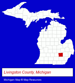
The Michigan counties map at upper right shows Livingston County, highlighted in red. Use the menu below to display interactive maps of Howell, either in a frame on this page or in full-screen mode.
Use the menu below to display categorized Howell directories.
| Howell Products and Services Directory | ||
|---|---|---|
| Auto Service | Home Improvement | Metals |
| Schools | ||
Selected Howell, Michigan Listings
These randomly selected Howell listings provide some insight into the city's cultural environment and economic climate.- Door & Door Frame Dealers
- Accountants
- Certified Public Accountants
- Pet Care Services
- Pet Grooming & Boarding
- Pet Sitting & Day Care
- Pet Grooming
- Building & Home Construction
- Builders & Contractors
- Roofing Contractors
- Roofing
- Libraries
- Physicians & Surgeons
- Alternative Medicine
- Chiropractors
- Boarding Stables
- Equestrian Sports & Recreation
- Horse Trainers
- Floors & Flooring Retail
- Paint Stores
- Wood & Laminate Flooring
- Adhesives & Glues
- Mattresses Retail
- Industrial Equipment & Supplies Dealers
- Metals
- Die Cutting Equipment & Supplies
- Tool & Die Maker Equipment & Supplies
Nearby Michigan Cities and Towns *
- Ann Arbor (44) - Ann Arbor, Michigan products & services directory.
- Brighton (11) - Brighton, Michigan demographics and directory.
- Dexter (2) - Dexter, Michigan information and maps.
- Fenton (2) - Fenton, Michigan information and maps.
- Flint (15) - Flint, Michigan demographics and directory.
- South Lyon (3) - South Lyon, Michigan information and maps.
* Parenthesized numbers indicate economic activity levels.
Copyright © 2011-2026 RegionalDirectory.us. All rights reserved.