Hudsonville, Michigan Map and Directory
Regional Directory > States Menu > Michigan
 According to the United States Census Bureau, Hudsonville is a City that is located in Ottawa County, Michigan at 42.87 degrees North and 85.87 degrees West.
The city's time zone is America/Detroit, and the city's primary telephone area code is 616.
The land area of Hudsonville is about 4.14 square miles, whereas the water area of the city is about 0.00 square miles.
Ottawa County's land area is about 563 square miles, so the city occupies about 0.7 percent of the county's total land area.
According to the United States Census Bureau, Hudsonville is a City that is located in Ottawa County, Michigan at 42.87 degrees North and 85.87 degrees West.
The city's time zone is America/Detroit, and the city's primary telephone area code is 616.
The land area of Hudsonville is about 4.14 square miles, whereas the water area of the city is about 0.00 square miles.
Ottawa County's land area is about 563 square miles, so the city occupies about 0.7 percent of the county's total land area.
The Census Bureau estimates that Hudsonville had about 7,348 residents in 2019, which is approximately 1,775 people per square mile of land area.
According to recent American Community Survey data, the median household income in Hudsonville was about $64,189 per year.
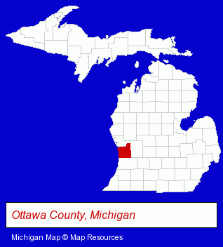
The Michigan counties map at upper right shows Ottawa County, highlighted in red. Use the menu below to display interactive maps of Hudsonville, either in a frame on this page or in full-screen mode.
Use the menu below to display categorized Hudsonville directories.
| Hudsonville Directory Page: | Schools |
|---|
Selected Hudsonville, Michigan Listings
These Hudsonville listings provide some insight into the city's cultural environment and economic climate. American Autocoat- Plastic & Plastic Products Wholesale & Manufacturers
- Moving & Storage
- Household Goods & Furniture Storage
- Fruits & Vegetables Retail
- Fruits & Vegetables Wholesale
- Lawn & Garden Equipment & Supplies Retail
- Nurseries
- Garden Centers
- Greenhouses
Nearby Michigan Cities and Towns *
- Comstock Park (1) - Comstock Park, Michigan information and maps.
- Grand Rapids (81) - Grand Rapids, Michigan products & services directory.
- Grandville (4) - Grandville, Michigan information and maps.
- Jenison (3) - Jenison, Michigan information and maps.
- Wyoming (5) - Wyoming, Michigan demographics and maps.
- Zeeland (2) - Zeeland, Michigan information and maps.
* Parenthesized numbers indicate economic activity levels.
Copyright © 2011-2026 RegionalDirectory.us. All rights reserved.