Ludington, Michigan Map and Directory
Regional Directory > States Menu > Michigan
 According to the United States Census Bureau, Ludington is a City that is located in Mason County, Michigan at 43.96 degrees North and 86.45 degrees West.
The city's time zone is America/Detroit, and the city's primary telephone area code is 231.
The land area of Ludington is about 3.37 square miles, whereas the water area of the city is about 0.34 square miles.
Mason County's land area is about 495 square miles, so the city occupies about 0.7 percent of the county's total land area.
According to the United States Census Bureau, Ludington is a City that is located in Mason County, Michigan at 43.96 degrees North and 86.45 degrees West.
The city's time zone is America/Detroit, and the city's primary telephone area code is 231.
The land area of Ludington is about 3.37 square miles, whereas the water area of the city is about 0.34 square miles.
Mason County's land area is about 495 square miles, so the city occupies about 0.7 percent of the county's total land area.
The Census Bureau estimates that Ludington had about 8,108 residents in 2019, which is approximately 2,406 people per square mile of land area.
According to recent American Community Survey data, the median household income in Ludington was about $45,302 per year.
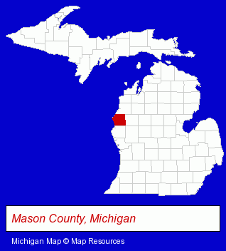
The Michigan counties map at upper right shows Mason County, highlighted in red. Use the menu below to display interactive maps of Ludington, either in a frame on this page or in full-screen mode.
Use the menu below to display categorized Ludington directories.
| Ludington Products and Services Directory | |
|---|---|
| Hotels | Restaurants |
Selected Ludington, Michigan Listings
These representative Ludington listings provide some insight into the city's cultural environment and economic climate.- Home Furnishings Stores
- Furniture Stores
- Office Furniture & Equipment Dealers
- Furniture Wholesale & Manufacturers
- Packaging & Shipping Materials Retail
- Home Furnishings Stores
- Furniture Stores
- Furniture Wholesale & Manufacturers
- Bedroom Furniture
- Visual Arts
- Crafts & Craft Supplies Retail
- Yarn
- Clothing & Accessories Retail
- Jewelers
- Watches Retail
- Lodging
- Hotels
- Motels
- Steak Restaurants
- American Restaurants
- Pizza Restaurants
- Lodging
- Hotels
- Motels
- Hotel & Motel Reservations
Nearby Michigan Cities and Towns *
- Muskegon (12) - Muskegon, Michigan demographics and directory.
- Traverse City (30) - Traverse City, Michigan solutions directory and maps.
* Parenthesized numbers indicate economic activity levels.
Copyright © 2011-2026 RegionalDirectory.us. All rights reserved.