Muskegon, Michigan Map and Directory
Regional Directory > States Menu > Michigan
 According to the United States Census Bureau, Muskegon is a City that is located in Muskegon County, Michigan at 43.23 degrees North and 86.25 degrees West.
The city's time zone is America/Detroit, and the city's primary telephone area code is 231.
The land area of Muskegon is about 14.21 square miles, whereas the water area of the city is about 3.91 square miles.
Muskegon County's land area is about 499 square miles, so the city occupies about 2.8 percent of the county's total land area.
According to the United States Census Bureau, Muskegon is a City that is located in Muskegon County, Michigan at 43.23 degrees North and 86.25 degrees West.
The city's time zone is America/Detroit, and the city's primary telephone area code is 231.
The land area of Muskegon is about 14.21 square miles, whereas the water area of the city is about 3.91 square miles.
Muskegon County's land area is about 499 square miles, so the city occupies about 2.8 percent of the county's total land area.
The Census Bureau estimates that Muskegon had about 36,565 residents in 2019, which is approximately 2,573 people per square mile of land area.
According to recent American Community Survey data, the median household income in Muskegon was about $32,433 per year.
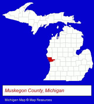
The Michigan counties map at upper right shows Muskegon County, highlighted in red. Use the menu below to display interactive maps of Muskegon, either in a frame on this page or in full-screen mode.
Use the menu below to display categorized Muskegon directories.
| Muskegon Products and Services Directory | ||
|---|---|---|
| Auto Service | Building Materials | Home Furnishings |
| Home Improvement | Metals | Physicians |
| Printing and Publishing | Restaurants | Schools |
| Steak Restaurants | Steel Fabrication | Visual Arts |
Selected Muskegon, Michigan Listings
These randomly selected Muskegon listings provide some insight into the city's cultural environment and economic climate.- Art Galleries & Dealers
- Nurses
- Nurse Practitioners
- Oncology Physicians & Surgeons
- Surgeons
- Podiatry Physicians & Surgeons
- Orthopedics Physicians & Surgeons
- Foot & Ankle Surgeons
- Industrial Equipment & Supplies Dealers
- Industrial Equipment & Supplies Wholesale & Manufacturers
- Automation Equipment & Systems Dealers Industrial
- Plumbing Equipment Rental
- Dentists
- Metal Finishing
- Banks
- Financial Institutions
- Credit Unions
- Personal Loans
- Mortgage & Loan Banks
- Photography
- Professional Photographers
- Specialty Photographers
- Aerial Photographers
- Lodging
- Hotels
- Motels
- Bed & Breakfasts
- Bed & Breakfast Reservations
- Business Consultants & Advisors
- Advertising Agencies & Consultants
- Sign Dealers
- Signs Wholesale & Manufacturers
- Commercial Signs
- Industrial Equipment & Supplies Wholesale & Manufacturers
- Construction Machinery & Equipment Wholesale & Manufacturers
- Crane Rental & Leasing
- Heavy Construction Equipment Rental
Nearby Michigan Cities and Towns *
- Grand Haven (6) - Grand Haven, Michigan demographics and maps.
- Grand Rapids (81) - Grand Rapids, Michigan products & services directory.
- Spring Lake (2) - Spring Lake, Michigan information and maps.
- Zeeland (2) - Zeeland, Michigan information and maps.
* Parenthesized numbers indicate economic activity levels.
Copyright © 2011-2026 RegionalDirectory.us. All rights reserved.